Subject: Gulf of Mexico & Caribbean
Period: 1793 (circa)
Publication: Encyclopaedia; or a Dictionary of Arts, Sciences, and Miscellaneous Literature
Color: Black & White
Size:
11.1 x 6.8 inches
28.2 x 17.3 cm
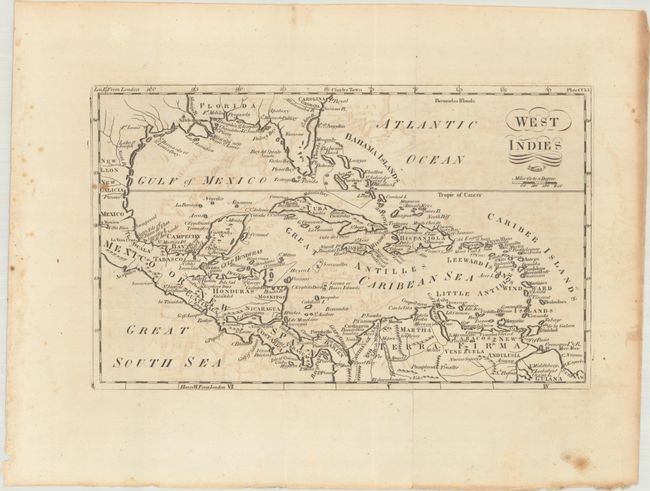
A handsome small map of the West Indies and the Gulf of Mexico presenting a Florida peninsula that is too wide and locates Fort St. Augustine, Fort Mobile and Fort Louis. The map identifies the Bahamas, Cuba, Jamaica, Hispaniola, the Windward and Leeward Islands, Central America, and the northern tip of South America. Marked plate CCLV in the top right corner. Engraved by Samuel Allardice. Published in Vol. IX of Thomas Dobson's 18-volume Encyclopaedia; or a Dictionary of Arts, Sciences, and Miscellaneous Literature.
References:
Condition: B+
Issued folding with some light offsetting and a couple of spots of foxing along the left border. Two tiny holes are visible when held to light.