Subject: Northwestern Mexico
Period: 1825 (dated)
Publication:
Color: Black & White
Size:
22.1 x 34.4 inches
56.1 x 87.4 cm
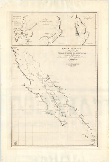
This scarce sea chart was created for Guadalupe Victoria, the first president of Mexico shortly after Mexico gained independence from Spain. The map is a copy or a derivative of a map created in Spain by the Direccion de Hidrografia (Spanish Hydrographic Service). This map is one of a number of Spanish charts that were reissued in 1825 by the new Mexican government. The chart depicts Baja California (beginning at San Diego) and the eastern coastline of the Gulf of California south to C. Corrientes, which is just south of Puerto Vallarta. Soundings, rocks, shoals, and anchorages are noted along the coasts. Although the interior is left blank, the topography of the coastlines is illustrated by hachures. At top are three large insets depicting plans of the Port of Guaymas along the eastern coast of the Gulf of California, and the Bay of La Paz and Port of Pichilingue near the southern tip of Baja California.
References:
Condition: B+
A dark impression with some small dampstains in the image and along the left border. The sheet has been fully backed with tissue to reinforce and repair several edge tears at top and bottom including tears that extend 14" at top and 3.5" at bottom. Several edge chips in the margins have been archivally reinstated.