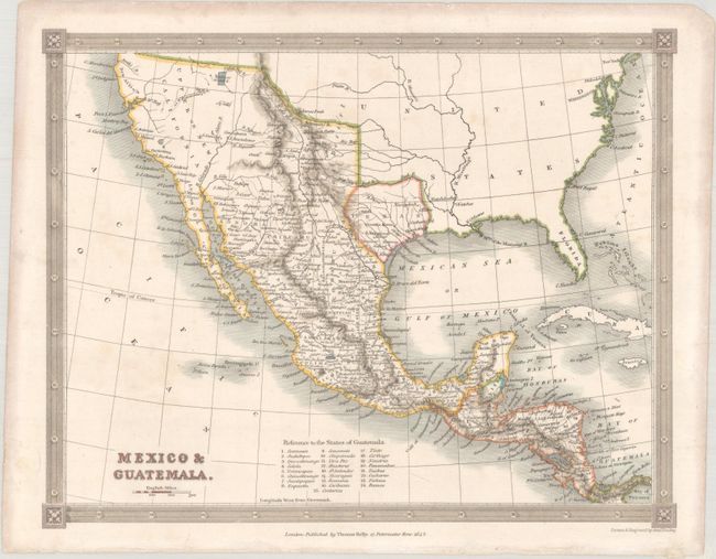
Subject: United States & Mexico, Texas
Period: 1842 (dated)
Publication:
Color: Hand Color
Size:
9.8 x 7.7 inches
24.9 x 19.6 cm
The crisply engraved map features the Independent Republic of Texas with S. Antonio de Bexar indicated as the capital and locates Victoria, Nacogdoches, Harrisburg, Gaurdia Barca, and several more settlements. Mexico controls the entire southwest and California as Upper or New California. The Baja is Lower or Old California. The Great Salt Lake is Youta or Great Salt L. The Great Basin shows pre-Fremont information with several rivers flowing to the Pacific from the Great Basin. New Albion is in the vicinity of Cape Mendocino. Details include watersheds, Indian tribes, and scores of towns and villages. The map extends to include Florida and most of the East Coast, but all interior detail stops at the Mississippi except to name a few large cities. Table at bottom keys to 25 States of Guatemala.
References:
Condition: A
There is faint foxing and marginal toning.