Subject: World
Period: 1815 (dated)
Publication: Thomson's New General Atlas
Color: Hand Color
Size:
19.9 x 19.8 inches
50.5 x 50.3 cm
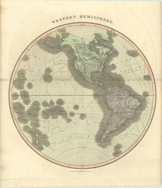
A. Western Hemisphere. This large map extends to include New Zealand and most of Oceania with numerous explorer routes throughout the oceans. A single, unnamed mountain range extends the length of the Western Hemisphere. In North America, Alaska is coming into form and Greenland is attached to Canada. Numerous towns, rivers, and Indian lands are noted.
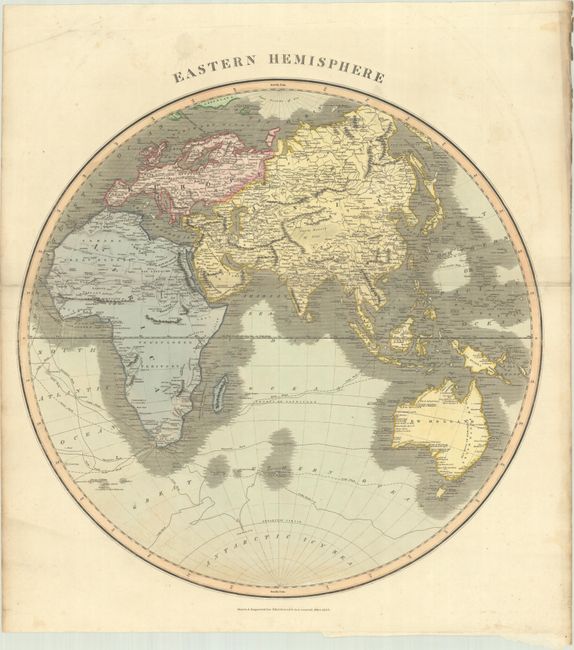
B. Eastern Hemisphere. This detailed hemispheric map extends to include New Holland (Australia), New Guinea (still not completely delineated), and some of the South Pacific islands. The interior of southern Africa is noted as "Unexplored Territory" and the fictitious twin lakes as the source of the Nile have been removed. The routes of numerous explorers are shown in the southern oceans, including Cook, Vancouver and Perouse.
References:
Condition: B+
Full contemporary color with minor offsetting and foxing primarily in the blank margins. The eastern sheet has a bit of toning at the bottom of the hemisphere.