Subject: Oklahoma
Period: 1904 (published)
Publication:
Color: Printed Color
Size:
6.1 x 9.4 inches
15.5 x 23.9 cm
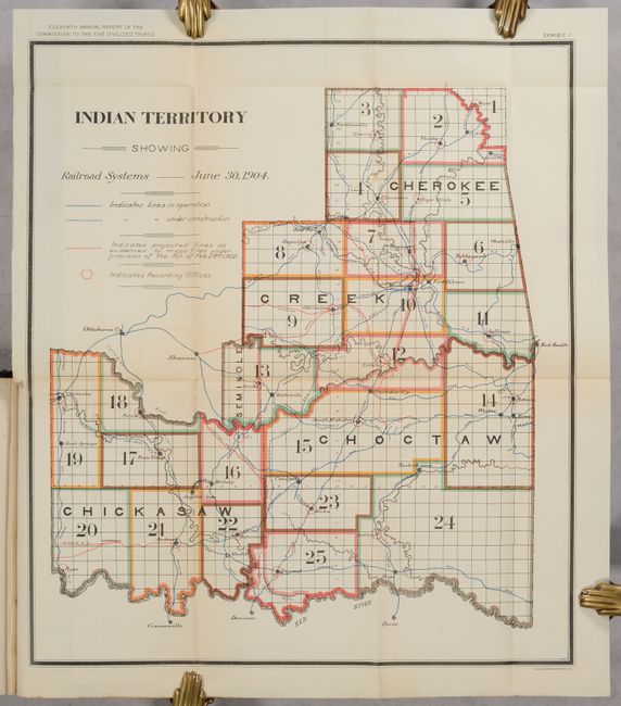
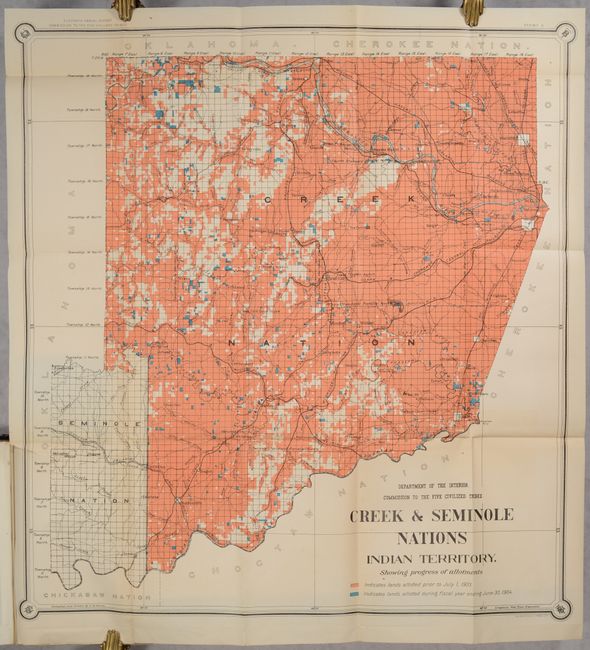
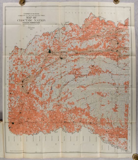
This is the eleventh annual report of the Commission to the Five Civilized Tribes, with additional reports by the Indian Inspector for the Indian Territory, and a listing of bids opened and contracts awarded for the Indian Service. Accompanying the reports are seven folding maps which illustrate the progress of the allotment work including:
A. Indian Territory Showing Railroad Systems, June 30, 1904 (15.4 x 17.8").
B. Map of Seminole Nation (9.3 x 15.3").
C. Creek & Seminole Nations Indian Territory Showing Progress of Allotments (24.5 x 26.4").
D. Map Showing Progress of Allotment in Cherokee Nation (25.6 x 34.9").
E. Map of Choctaw Nation Indian Territory (32.6 x 36.8")
F. Map of Choctaw Nation Indian Territory Coal and Asphalt Segregation and Pine Timber of Commercial Value (32.6 x 36.8").
G. Map of Chickasaw Nation... (30.3 x 33.3").
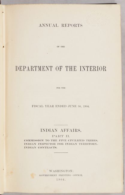
The Commission’s report notes the enrollment had been ongoing for six years and that 90% of the tribe population had completed enrollment. More than 200,000 "citizens and claimants" were personally examined. Work was expected to be completed by July 1, 1905. Each claimant would receive 40 acres. The text also provides details regarding the changes in legislation that had to be taken into account, definition of terms and qualification for allotments, etc. This is an important document describing the breakup of the Indian Territory, leading up to its inclusion in the State of Oklahoma in 1907. 864 pages. Hardbound in brown cloth with gilt title on spine.
References:
Condition: B+
The folding maps are clean and bright with some faint color offsetting, minor foxing, and short binding tears to a couple of maps. In addition, there are light perforated library stamps in the map corners that only mildly detract. Text is generally clean and bright with a few additional library stamps. Covers have light wear.