Subject: Mississippi
Period: 1866-1903 (dated)
Publication:
Color:
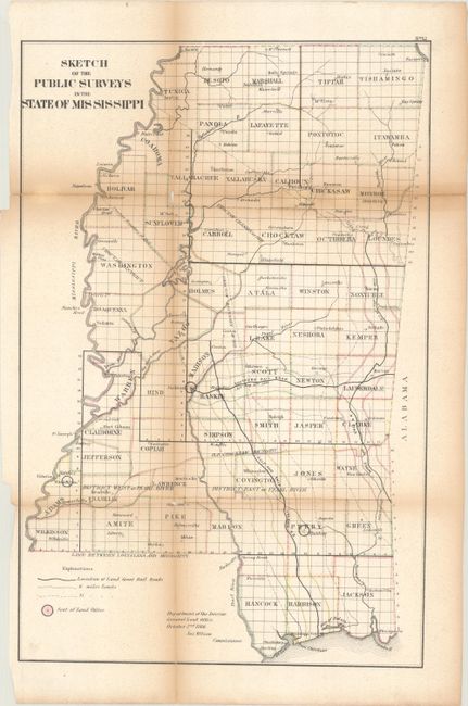
A. Sketch of the Public Surveys in the State of Mississippi, by General Land Office, dated 1866, hand color (11.6 x 17.9"). An uncommon map by the GLO with counties outlined in color and many place names, rivers, etc. Railroads are shown with their land grants delineated at 6 mile and 15 mile limits. This example shows the Old Choctaw Boundary line, and three Land Office Seats in Adams, Perry and Madison Counties. Another notation locates the Choctaw Cession of 1830. Condition: Folding, as issued, with toning along the folds and two fold intersection splits with small loss. Several fold separations have been closed on verso with a combination of archival and non-archival tape. Binding edge close, as issued. (C+)
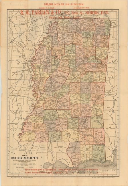
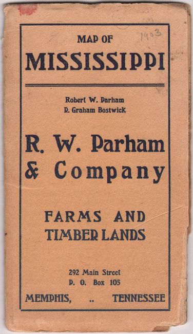
B. Map of Mississippi Showing Counties, Towns, Villages, Rivers, Railroads and Congressional Districts, dated 1903, printed color (12.7 x 18.8"). An ephemeral land promotion pocket map published by Kenyon Printing & Mfg. Co. for R. W. Parham & Co. of Memphis. The map features extensive overprinting, e.g. "100,000 acres for sale in this state," "Farms and Timber Lands," etc. Index on verso. Folds into printed wrappers with more advertising, including "Famous Delta plantations with or without personal property." Robert W. Parham and R. Graham Bostwick are listed as principles of the company. Condition: Issued folding with a few fold separations primarily at the junctions. Front cover with a little missing paper at lower right corner, well outside the title. (B+)
References:
Condition:
See description above.