Subject: Key West, Florida
Period: 1860 (published)
Publication: American State Papers
Color: Black & White
Size:
10.6 x 6.1 inches
26.9 x 15.5 cm
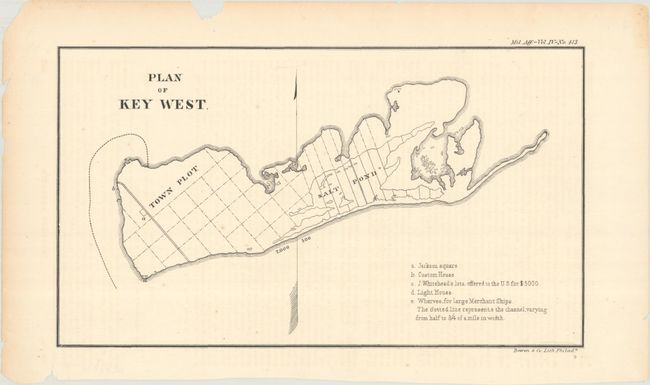
This small map of Key West is based upon the original survey by William Whitehead in 1829. The island is laid out in a grid pattern with a Town Plot, Salt Pond, and key to five locations including Jackson Square, Customs House, lighthouse, wharves, and "lots offered to the U.S. for $5000." A large directional arrow bisects the island and orients north to the top. The map originally accompanied the report "Considerations Showing the Expediency of Constructing Fortifications on the Island of Key West, in Florida" in 1829 (document #413, 21st Congress, 1st Session) and published here in the fourth Military Affairs volume of the American State Papers.
References:
Condition: B+
There is light offsetting from an opposing page of text, minor foxing, and a short repaired edge tear at bottom that just passes the neatline.