Catalog Archive
Auction 196, Lot 20

"A New & Accurate Map of All the Known World Drawn from the Latest & Most Authentic Surveys Assisted by the Best & Most Approved Modern Maps Charts &c...", Bowen, Emanuel
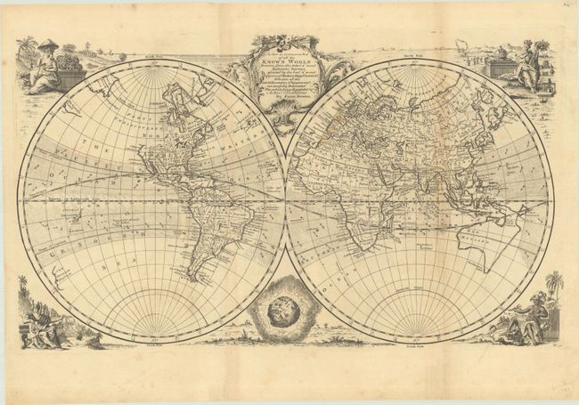
Subject: World

Period: 1747 (circa)

Publication: A Complete System of Geography

Color: Black & White

Size:
21 x 12.2 inches
53.3 x 31 cm
Download High Resolution Image
(or just click on image to launch the Zoom viewer)

Vignettes of indigenous peoples representing Asia, America, Europe and Africa surround this well-engraved double-hemisphere map. An attractive rococo title cartouche rests between the hemispheres. Only a few cities are named in North America, and the northwest coast is noted as Parts Undiscovered. Australia is misshapen and connected to Van Diemens Land with indistinct eastern and southern coastlines. New Zealand is mapped only on the west coast with no evidence of two islands. Crosshatched areas locate and show direction of trade winds. This is the first state, with plate number 90 at bottom right.

References: McCorkle (18th C. Geography Books) #17-2 (Vol I); Shirley (BL Atlases) T.BOW-2a #4.

Condition: B

A crisp impression, issued folding with light toning along the folds, scattered foxing, a stain in western Europe, and marginal soiling.

Estimate: $600 - $750

Sold for: $350

Closed on 2/7/2024

Archived