Subject: World
Period: 1746 (dated)
Publication:
Color: Hand Color
Size:
21.3 x 18 inches
54.1 x 45.7 cm
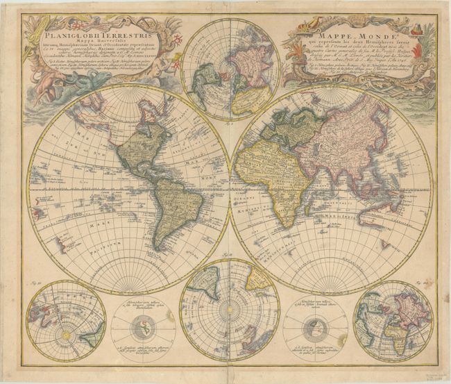
This handsome, double-hemisphere world map was drawn by Georg Moritz Lowitz, based on the work of Johann Mathias Haas. It includes four polar spheres, each in a different projection, and two interesting diagrams depicting the earth, as it would be seen from space. North America has a speculative border above California with the recent discoveries of Bering and Tschirikow noted in 1741. The large, mythical Xarayes Lake appears in the center of South America. In the South Pacific there are partial coastlines of New Zealand, Australia, and Tasmania. Two very large, decorative cartouches contain the titles, one in Latin, the other French. The Latin cartouche features mythical sea creatures and wind heads while the other is surrounded by fruit and animals representing the bounty of the earth along with four headdresses representing the four continents.
References:
Condition: B+
Contemporary color in the map with later color in the cartouches on a sturdy, and lightly toned watermarked sheet. There is light soiling, a couple of stains at bottom right, and archival repairs to a centerfold separation that extends through Fig. II at bottom, an adjacent 1" tear, and a tear that enters 1" into the image at top center.