Subject: Southern United States, Civil War
Period: 1863 (dated)
Publication:
Color: Hand Color
Size:
52.1 x 37.4 inches
132.3 x 95 cm
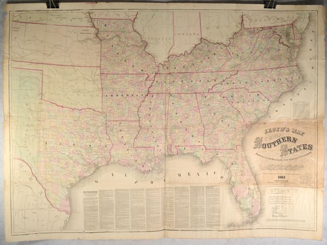
This mammoth Civil War map extends from the Mason-Dixon line south to Florida and west to Missouri and Texas. It is notable for being one of the few versions of the map to show the majority of Texas (most showed just far eastern Texas), with the western portion noted as "Texas Territory." Details include county development, cities and towns, courthouses, forts, completed railroads and projected railroads. The verso contains newspaper-style text describing counties in Virginia and Missouri with title "Lloyd's Military Map and Gazetter of the Southern States." According to Stephenson, Lloyd produced at least 5 editions of this map.
References: Stephenson (Civil War) #41.2.
Condition: C+
Issued on thin, newspaper-style paper with archival repairs to numerous fold separations as well as chips primarily along a fold above the title with some small loss of image. There is toning around the title, some minor dampstains, and a number of edge tears and chips confined to the margins.