Subject: Atlases
Period: 1845 (circa)
Publication:
Color: Hand Color
Size:
14.6 x 21.5 inches
37.1 x 54.6 cm
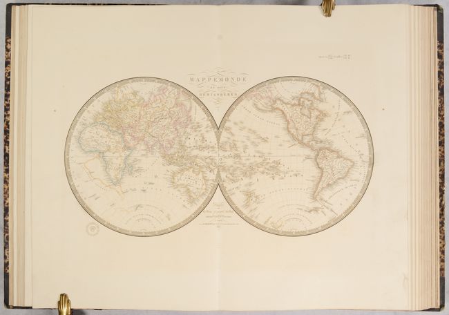
This complete atlas contains 64 double-page maps of both the ancient and modern world. The contents include 14 of the ancient world and 50 of the modern world. The maps of the modern world break out as follows: World (3), Europe (23), Asia (5), Pacific (4), Africa (6) and Americas (9). Included in this count is a large folding map of France, which the table of contents lists as two separate maps. All of the maps have Brue's decorative keyboard-style border and embossed stamp. Although there is no publication date on the title page, the maps are dated between 1826-45. Three maps feature the independent Republic of Texas:
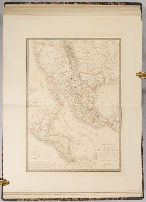
The map titled Carte Generale des Etats-Unis Mexicains de la Republique du Texas et des Etats de l'Amerique Centrale is the only one dated 1845. This uncommon map details the independent Republic of Texas, the western United States and Mexico. The lower left quadrant is filled with a large inset of Central America that is shown on the same scale as the main map. There is excellent detail throughout, with the title containing one of the few direct references to the Republic of Texas.
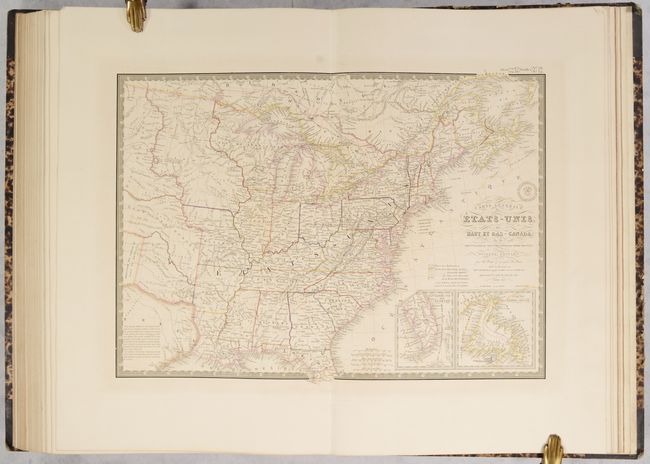
The map of the United States is titled Carte Generale des Etats-Unis, des Haut et Bas-Canada, de la Nouvle. Ecosse, du Nouvau. Brunswick, de Terre-Neuve, &a. Seconde Edition, and covers the eastern United States to about the 100th meridian, with a portion of southern Canada. The northwestern territories include a large Iowa Territory and Ter. Du Nord Ouest that encompasses present-day Wisconsin, the Upper Peninsula of Michigan, and eastern Minnesota. The rest of the West past Missouri and Arkansas is designated as Indian Districts. The eastern half of the Republic of Texas is shown but is mostly blank with a lengthy notation filling the interior. Insets of the tip of Florida and Newfoundland are located in the lower right.
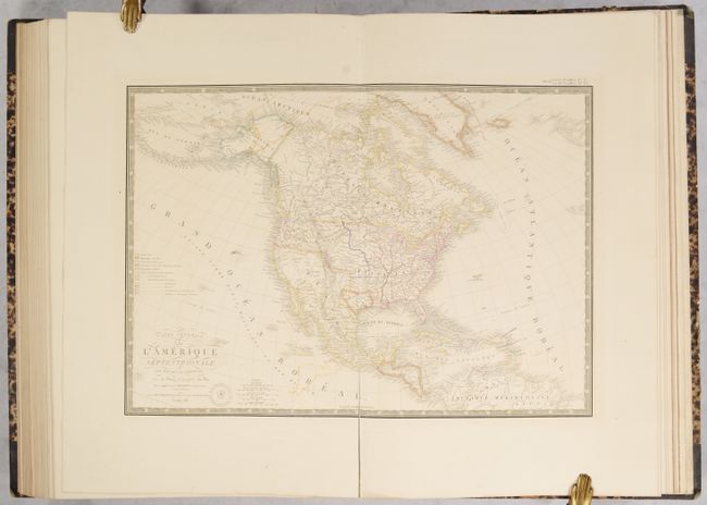
The map of North America, Carte Generale de l'Amerique Septentrionale, et des Iles qui en Dependent also features the Independent Republic of Texas. Alaska is Amerique Russe and is still a bit misshapen. The individual state and territorial borders are shown up to the Mississippi River, with the large Arkansas Territory extending over the top of eastern Texas. The legend identifies, via color, twelve different countries including the colonial holdings of France, England, Spain, Denmark, Holland, and Sweden.
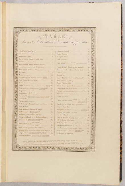
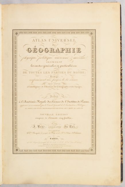
Title page, list of maps, dedication, and 64 maps. Elephant Folio. Quarter brown leather with tips over mottled paper-covered boards with printed title label on front cover and gilt tooling and titling on spine.
References:
Condition:
The maps have contemporary outline color, minor toning, and light to moderate offsetting and range in condition from very good (B+) to good (B). The map of North America has a long centerfold separation at bottom. The four maps related to North America have short edge tears that have been closed on verso with archival tape. The title page is toned and soiled. The front and back free-endpapers have toning, foxing and a few edge tears. The front hinge is starting, however this heavy volume is still well intact. The covers are worn with some abrasions and bumped corners. The spine is also worn and is beginning to detach at top and bottom.