Subject: North Pacific Ocean
Period: 1795 (circa)
Publication: Voyages de la Chine
Color: Hand Color
Size:
24.1 x 16.8 inches
61.2 x 42.7 cm
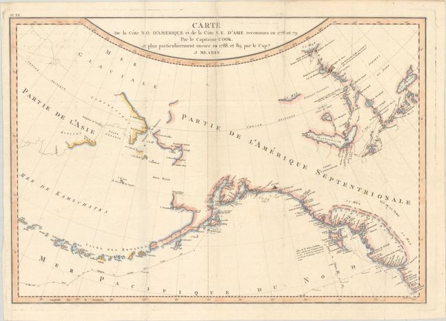
This scarce and interesting map of Alaska and the Bering Strait details the explorations of Captain John Meares. As noted in the title, the map shows the region explored by Captain Cook, but the primary focus is on the tracks of Meares' voyage in 1788-89, ten years after Cook's expedition. Meares is one of the more colorful figures in the early European exploration of the Northwest coast and Alaska. He claimed many of the discoveries of others as his own and rekindled the idea of the Sea of the West and a Northwest Passage. His mythical inland sea, Archipel du Nord, appears stretching from the Strait of Juan de Fuca northwards to just north of the Queen Charlotte Islands, although it is not completely delineated. A note indicates that the American sloop Lady Washington, captained by Robert Gray, had explored this sea in 1789. This was a complete fabrication on the part of Meares; nevertheless it gave new credence to the idea and appears on several later maps as well.
References: Kershaw #1174; McGuirk #218.
Condition: B+
Issued folding on a watermarked sheet with minor foxing and offsetting and a few tiny wormholes. There is a bit of extraneous creasing along a couple folds at top.