Subject: Serbia & Bosnia and Herzegovina
Period: 1750 (circa)
Publication:
Color: Hand Color
Size:
44.1 x 20.1 inches
112 x 51.1 cm
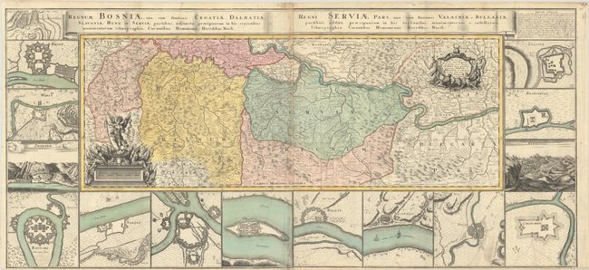
This two-sheet map depicts the theater of war in northern Bosnia and Serbia during the Russo-Turkish War as the Habsburg Monarchy entered the war in 1737. The map features Belgrade at top center and extends southeast to Sofia, Bulgaria and west to Bihac, Bosnia and Herzegovina. Two cartouches adorn the map featuring river gods and the Archangel Michael holding the chains of two prisoners. Surrounding the map are panoramic views of Zvornik and Serajevo, as well as 13 bird's-eye plans of fortified cities in the region, including Belgrade, Nis, Kragujevac, Sabac, and Bihac (Wihaz). This map is the work of Johann Friedrich Oettinger. Printed from two separate plates onto two sheets, joined.
References:
Condition: B+
Excellent impressions with full contemporary color, issued folding with light soiling, a few spots of foxing, and a narrow bottom margin.


