Subject: Southern France
Period: 1712 (dated)
Publication: Atlas ou Recueil de Cartes Geographiques...
Color: Hand Color
Size:
26.9 x 17.9 inches
68.3 x 45.5 cm
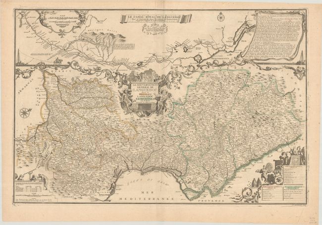
This handsome and uncommon map shows the Languedoc region along the border with Spain and the Mediterranean. The map is oriented with north to the top right corner, and extends from Toulouse in the west to Valence in the east, bounded by the Garonne and Rhone Rivers. Hundreds of tiny towns are labeled, mountains are shown pictorially, and the Canal Royal (renamed Canal du Midi during the French Revolution) is illustrated. The Canal Royal is shown in greater detail in a large inset that occupies the top third of the sheet, and includes a long note in a drape-style cartouche. Several other cartouches adorn the map, featuring surveyors, builders of the canal, religious symbols, and allegorical figures. Engraved by P. Starckman and sold by Benard.
References: Pastoureau, FER II C [29]
Condition: B+
Contemporary outline color on a bright sheet with a large watermark of a Maltese cross encircled in rosary beads, with some extraneous creasing along the centerfold and light soiling.