Subject: North Atlantic
Period: 1740 (circa)
Publication:
Color: Black & White
Size:
19.2 x 14.4 inches
48.8 x 36.6 cm
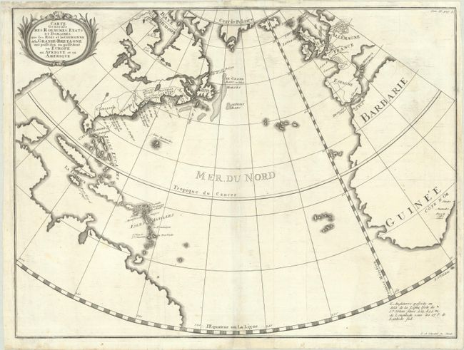
This is I.A. Schwebel's scarce variant of Paul de Rapin-Thoyras' map of the North Atlantic. Other than coastlines, it is left mostly blank in order to draw the reader's eyes to the British possessions around the world. Drawn on a conical projection, the map outlines the British colonies in North America prior to the French and Indian War, as well as British claims in Europe and Africa. This edition appears to be cartographically identical to the Rapin-Thoyras map, but the title is contained in a small decorative cartouche as opposed to large block letters across the upper image. We found no past auction results and only one dealer listing for this map in the last 35 years.
References:
Condition: B+
On a bright sheet with professional repairs to a 6" edge tear at bottom right and to several small areas of loss along the centerfold, with a tiny amount of image replaced in facsimile at bottom. There is some minor soiling along the sheet edges.