Subject: South America
Period: 1745 (circa)
Publication: Atlante Novissimo…
Color: Hand Color
Size:
16.8 x 13 inches
42.7 x 33 cm
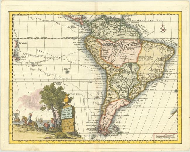
Beautifully engraved, Italian edition of Delisle's map of South America, extending from Nicaragua to Tierra del Fuego. Place names in South America are focused primarily along the coasts and along the Amazon and Parana Rivers. Two mythical lakes still appear: Lago Cassipa Dorada (a smaller version of the more-commonly known Lac de Parime) with the fabled city of Manoa to the southeast, and Lago des Xarayes in the center of the continent. Central Brazil is left blank except for a note explaining that the Brazilians claim that the S. Francesco and Real Rivers run for a long time together and connect with the Rio della Plata (Parana River). The south Pacific is also depicted with the routes of various explorers shown, including Magellan, le Maire, Olivier van Noort, and Mendana, with a portion of the Salomon Islands depicted. The large pictorial title cartouche features a mounted female surveying galleons in the distance and a hunter attempting to spear an alligator.
References: Mickwitz & Miekkavaara #64-43.
Condition: A
A crisp impression on a bright sheet with the watermark of three crescent moons, one tiny hole in the in Pacific, and minor toning along the centerfold.


