Subject: Antigua
Period: 1750-64 (circa)
Publication:
Color: Hand Color
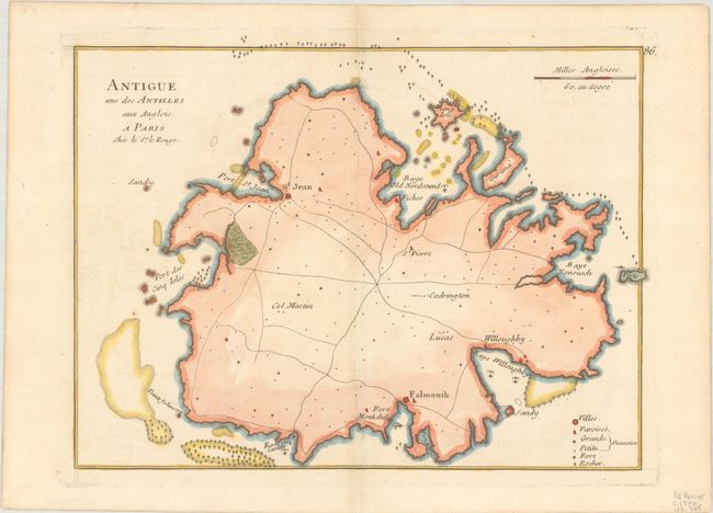
A. Antigue une des Antilles aux Anglois, by George Louis Le Rouge, circa 1750 (10.9 x 8.3"). A simple but handsome map of Antigua, the coastline shown with detail of anchorage, rocks, shoals, town, churches, forts and plantations. There is no topographical information in the interior where only a few roads are depicted. Condition: Watermarked sheet with a hint of toning and a light soft crease in upper left corner.
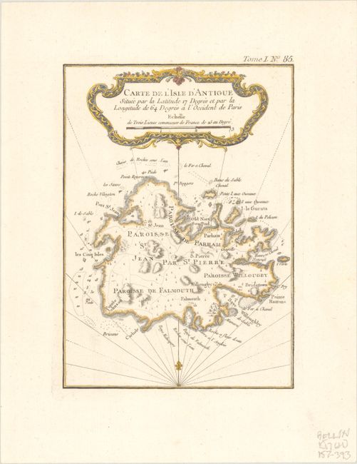
B. Carte de l'Isle d'Antigue Situee par la Latitude 17 Degres et par la Longitude de 64 Degres a l'Occident de Paris, by Jacques Nicolas Bellin, from Petit Atlas Maritime, published 1764 (5.7 x 8.0"). This fine small map of Antigua provides information on the roads, topography, parishes, towns, soundings and anchorages. It is adorned by a decorative title cartouche, rhumb lines, and fleur-de-lis. Reference: Tooley (MCC-55) #32. Condition: A crisp impression on a bright, watermarked sheet.
References:
Condition: A
See description above.