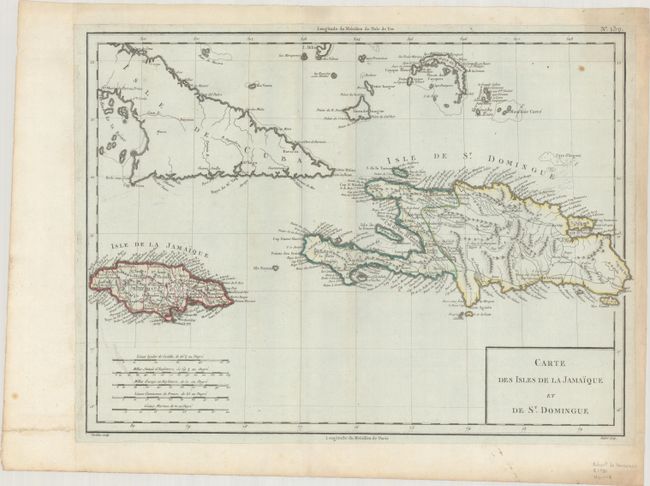
Subject: Hispaniola, Jamaica & Cuba
Period: 1797 (circa)
Publication:
Color: Hand Color
Size:
16.9 x 12.6 inches
42.9 x 32 cm
This chart of the Greater Antilles focuses on Jamaica and Hispaniola and includes the eastern portion of Cuba and part of the Bahamas. This map exemplifies the political situation in Jamaica and Hispaniola at the end of the 18th century. Jamaica is divided into ill-fitting counties with English-style names, such as Middlesex and Surry. The result of the 1777 Treaty of Aranjuez between France and Spain is evident in Hispaniola, which is divided between the two rival powers. Although the northern and southern portion of the border between present-day Haiti and the Dominican Republic are still relatively accurate, the central portion of the boundary was changed in the 20th century. Two standards are used to measure longitude: Paris and the Isle de Fer in the Canary Islands. The Canary Island standard was first proposed by Ptolemy when it was the western boundary of the known world. Various islands in the Atlantic Ocean and capital cities such as Paris, London and Washington were used as zero longitude. In 1634, Cardinal Richelieu proposed the Ile de Fer as a standard prime meridian to be recognized by all nations. However, as evidenced on this map, cartographers continued to use their nation's capital until the Greenwich Meridian was finally established at the International Meridian Conference in 1884. A simple box title cartouche and five distance scales fill the lower corners of the map. Engraved by Tardieu with lettering by Andre.
References:
Condition: B+
A nice impression with contemporary outline color on bluish paper that has been mounted on a large sheet of hand-laid paper. There is light soiling that is mostly apparent in the blank margins.


