Subject: Texas
Period: 1889 (dated)
Publication:
Color: Printed Color
Size:
23.1 x 22.7 inches
58.7 x 57.7 cm
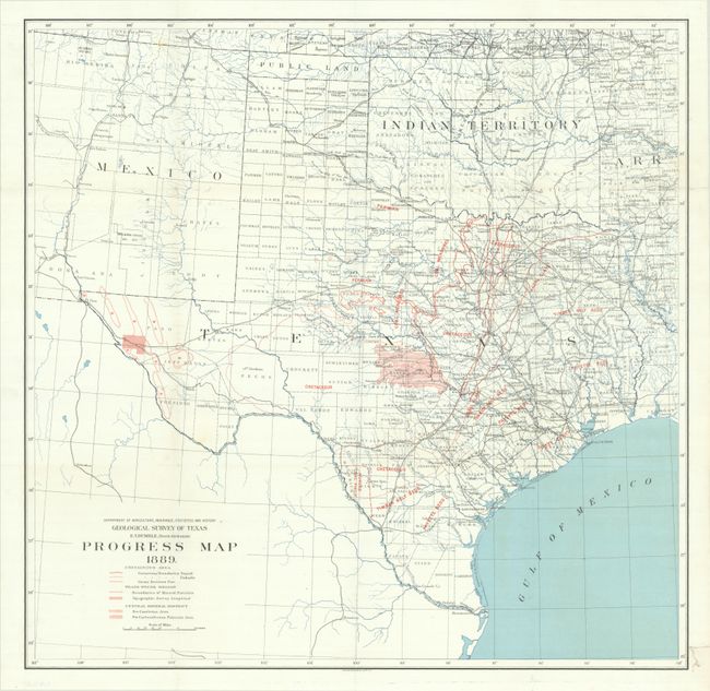
This map was published in the third geological survey conducted in the state of Texas by E.T. Dumble. It covers a large footprint including all of Texas and Indian Territory, along with portions of New Mexico, Arkansas and Louisiana. The map presents the various mineral districts, coal fields and measures, various beds, and the extent of the surveying. The underlying base map provides additional details including the river systems, railroads, and county delineations.
Texas' first geological survey, the Geological and Agricultural Survey of Texas, was conduced from 1858-67 and the second ran from 1870-73. Both were abruptly discontinued due to political reasons. The third survey worked under the newly named Geological and Mineralogical Survey and lasted for eleven years (later resumed by the University of Texas). Its primary purpose was to "search for ores, minerals, oils, coals, clays, and other materials possessing a commercial value."
References:
Condition: A
Issued folding on a bright sheet with archival repairs to a couple of tiny fold separations and an edge tear in the bottom right margin.