Subject: Pittsburgh, Pennsylvania
Period: 1902 (dated)
Publication:
Color: Printed Color
Size:
42.5 x 29.5 inches
108 x 74.9 cm
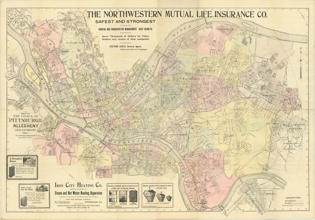
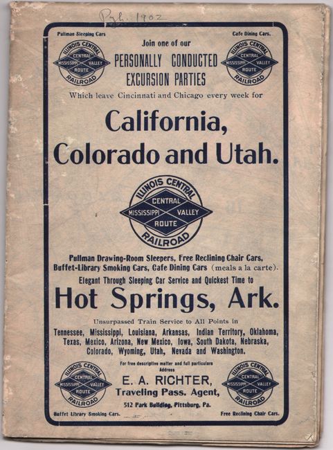
This very large and detailed map of Pittsburgh was published by R.L. Polk & Co at the height of the city's dominance of the steel industry. It is attractively colored by ward, and shows both railroads and street car lines. Large advertisements, several of which are illustrated, appear at top and bottom. The map folds into self wrappers with an advertising panel cover promoting tours to California, Colorado and Utah by the Illinois Central Railroad. We found only two institutional examples of this 1902 map on OCLC.
References:
Condition: B+
Issued folding on a clean bright sheet. There are several short splits at the fold junctions and tiny losses along two fold panels at top (below the L in "Life Insurance") mostly only noticeable when held to light.