Subject: World, World War II
Period: 1936 (published)
Publication:
Color: Printed Color
Size:
41.5 x 29.1 inches
105.4 x 73.9 cm
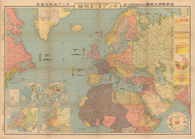
This wall-sized map presents Japan's view of Europe and surrounding powers just prior to the outbreak of World War II. The map is densely packed with information on the size of the armed forces, land mass, population, economy, trade relations, railways, ports, and telecommunications of key countries. A soldier, plane and ship are depicted for Germany, France, Britain, Italy, the Soviet Union and the United States, with the numbers below each indicating how many were at each country's disposal. Inset maps of Europe at bottom left show the ethnic distribution of peoples and the borders prior to World War I. At right are additional tables and charts giving detail on the relative population and wealth of each country. The two round charts illustrate Japan's imports and exports with the major powers in Europe and with the United States. This map was created by Fuchida Tadayoshi and published by Dai Nippon Yubenkai Kodansha as a supplement to King magazine.
References:
Condition: B+
Light toning mostly along the folds and edges of the sheet, with short separations and tiny tears along the folds at fold intersections.