Subject: New York, Railroads
Period: 1885 (published)
Publication:
Color: Black & White
Size:
6.1 x 9.4 inches
15.5 x 23.9 cm
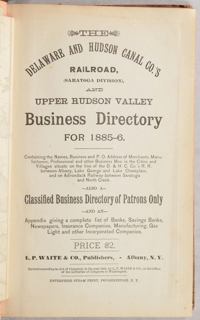
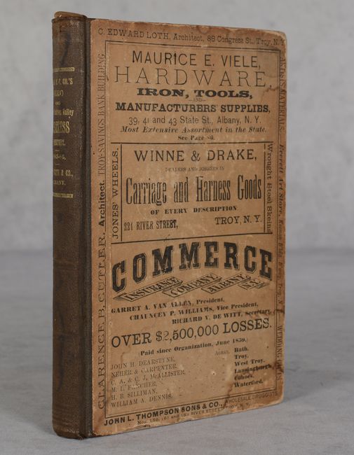
This business directory, published by L. P. Waite & Co. for the Delaware and Hudson Canal Company, features two fascinating railroad maps. The Delaware and Hudson Canal Company is the oldest continually operated transportation company in North America, and its railroad connected New York to New England, Montreal, and Quebec. The volume includes a plethora of information about businesses, educational institutions, and schools in the Upper Hudson Valley in New York. Advertisements on pink paper are interspersed throughout the text and on the pastedown and endpapers. 342 pages. Hardbound in quarter cloth over stiff printed paper boards with gilt title on spine. Maps are described below:
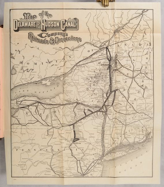
A. Map of the Delaware and Hudson Canal Company's Railroads & Connections (11.8 x 13.8"). This informative railroad map boldly delineates the tracks of the Delaware & Hudson Railway and its various connections throughout the northeastern United States and into Canada. The map covers the area from Philadelphia north to Quebec City, and from Niagara Falls east to Boston. Condition: Issued folding on a sheet with minor toning. (A)
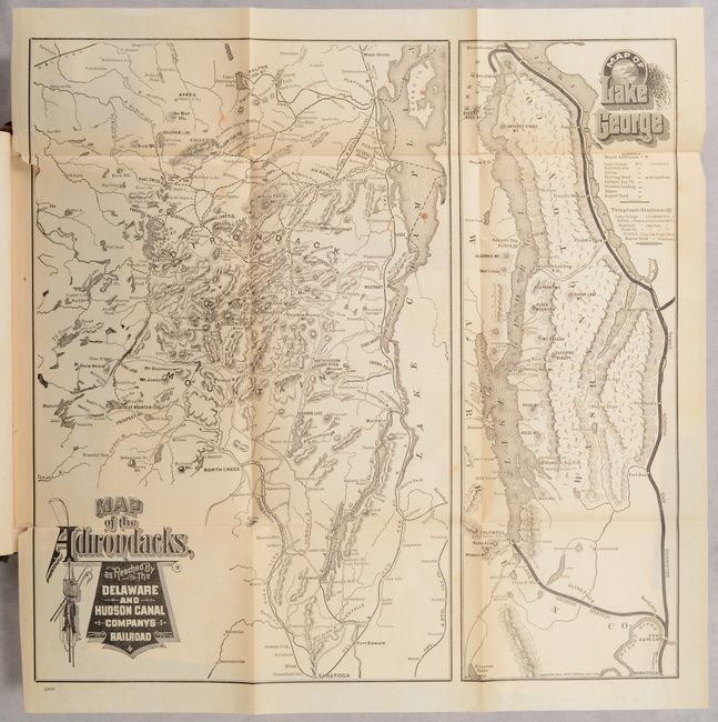
B. Map of the Adirondacks, as Reached by the Delaware and Hudson Canal Companys Railroad [on sheet with] Map of Lake George (14.1 x 14.0"). Two maps on one sheet. The map at left (9.0 x 14.0") depicts various railroads traversing the Adirondacks. It was published just a few years prior to the Delaware and Hudson Canal Company's purchase of the Adirondack Railway in 1889. The map at right (5.0 x 14.0") shows railways leading to Lake George, with post offices and telegraph stations identified. Condition: Issued folding with two 0.5" binding tears at left, a few light spots, and minor toning. (B+)
References:
Condition:
Conditions of the individual maps are described above. Text is very good with minor toning, occasional foxing, and a signature that is just starting to loosen. Covers have light dampstains with wear along the edges. Maps: A/B+, Binding: B