Subject: Montana, Aviation
Period: 1954 (dated)
Publication:
Color: Printed Color
Size:
39 x 24.3 inches
99.1 x 61.7 cm
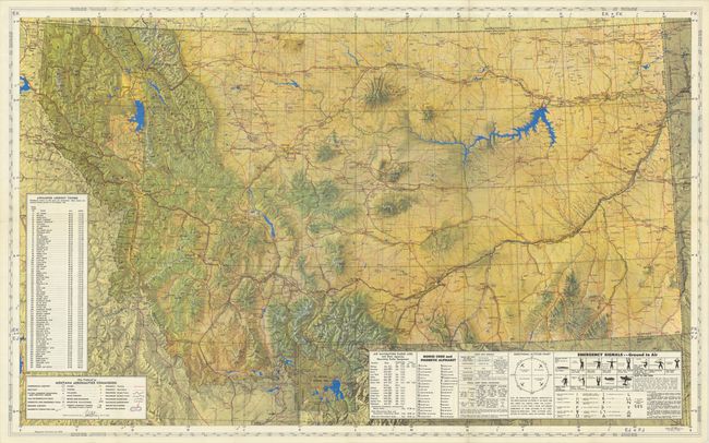
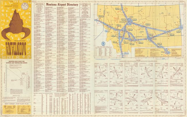
This highly detailed map was published by the Montana Aeronautics Commission and locates airports, private fields, railroads, mines and quarries, restricted areas, and more. The rugged topography of western Montana is presented with a three-dimensional effect, and bold color further highlights lakes (blue), towns (yellow) and the highway network (red). A table at left lists 73 airmarked lookout towers which are keyed to the map, and another table at lower right indicates radio aids, morse code, emergency signals, and more. The map extends into eastern Idaho, western North and South Dakota, and northwestern Wyoming including Yellowstone. The verso contains a comprehensive Montana Airport Directory and an additional map. Self-folds (7.0 x 12.4") into pictorial wrappers featuring a bison skull.
References:
Condition: A
A colorful example, issued folding.