Subject: Washington, D.C.
Period: 1846 (dated)
Publication:
Color: Black & White
Size:
17.4 x 13.3 inches
44.2 x 33.8 cm
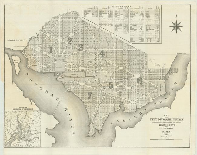
A scarce and detailed map of the nation’s capital by David McClelland. The city is divided into wards and presents the layout of streets including the long diagonals. Washington is bordered by the Potomac River and the Eastern Branch, now the Anacostia River. Georgetown, at the left and northwest of Rock Creek, is separately labeled. Each block is numbered, and a few major buildings including the Capitol and the Presidents House are labeled. The proposed landscape design for the Mall is shown with manuscript additions locating the Smithsonian Institution and Washington Monument. Includes an inset map of the region extending to Alexandria and an extensive list of “References” locating 15 public buildings, churches and burial grounds, including two identified as “African,” markets, banks and other buildings. McClelland went on to engrave the notable 1861 Boschke Topographical Map of Washington.
References:
Condition: B+
Issued folding with a binding trim at lower left. There is a light dampstain that extends about 3" into the image at left.