Catalog Archive
Auction 195, Lot 235

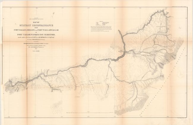
"Map of Military Reconnaissance from Fort Dalles, Oregon, via Fort Wallah-Wallah, to Fort Taylor, Washington Territory...", U.S. War Department

Subject: Washington & Oregon

Period: 1863 (published)

Publication: Sen. Ex. Doc. 43, 47th Congress, 3rd Session

Color: Black & White

Size:
35.8 x 21.3 inches
90.9 x 54.1 cm
Download High Resolution Image
(or just click on image to launch the Zoom viewer)

This is one of the Mullan Road maps, covering the section from Fort Taylor and Walla Walla to Fort Dalles. Locates the Emigrant Road to the States (Oregon Trail), Whitman's old Mission, the forts Taylor, old and new Wallah Wallah, and Dalles. The map also features excellent detail along the Columbia and Snake rivers. Wheat states "The Mullan Trail was unquestionably the most famous road ever constructed in the high Northwest."

References: Wheat (TMW) #1077.

Condition: B

Issued folding and now flattened and backed with tissue to reinforce and repair several fold separations. There is light toning along the folds, a small repaired hole at right, and minor loss at two fold junctions. Binding trims at left with loss of border have been replaced with old paper.

Estimate: $140 - $170

Sold for: $150

Closed on 11/15/2023

Archived