Subject: Upper Midwestern United States
Period: 1840 (dated)
Publication:
Color: Hand Color
Size:
24.8 x 20 inches
63 x 50.8 cm
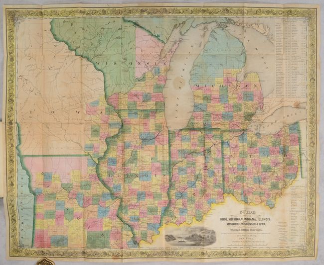
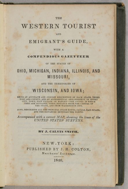
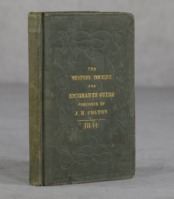
This is an early edition of this attractive pocket map that was issued as part of a guide for travelers and immigrants heading west. It is densely filled with information on stage roads, railroads, political divisions, towns and villages, watershed, and canals. The areas of Iowa and northern Wisconsin are sparsely settled. The Indian names are per Schoolcraft in this early edition. A "Proposed Military Road" to Council Bluffs and Ft. Calhoun is noted. Two large tables list the routing and distances for Steam Boat Routes throughout the area. The map is embellished with a decorative floral border and the engraved vignette "Maidens Rock, Lake Pepin on the Mississippi." The map is accompanied by a 180-page guide to the region. Folds into embossed green cloth covers (4.0 x 6.0") with gilt title on front cover. Published by J.H. Colton.
References: Howes #S-615; Karpinski p. 260.
Condition: B
Issued folding with full contemporary color. There is scattered foxing, light staining, and a number of small fold separations, mostly at the fold junctions, that have been closed on verso with old tape. Accompanying text has scattered foxing. Covers are lightly stained and worn with bumped corners.