Subject: Colonial Southern United States
Period: 1733 (published)
Publication:
Color: Black & White
Size:
7.3 x 5.3 inches
18.5 x 13.5 cm
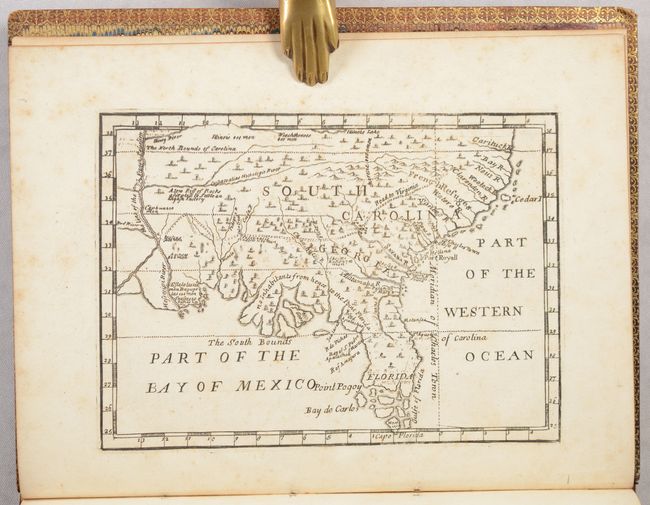
This scarce map is considered to be the first printed map to name the English colony of Georgia. This map was first published in 1732 in Some Account of the Designs of the Trustees for Establishing the Colony of Georgia in America, and was reissued the following year in Benjamin Martyn's Reasons for Establishing the Colony of Georgia with a few changes made to the plate. This map has also been attributed to James Oglethorpe, founder of the British Georgia colony in 1732, and presents extensive English claims southward to just north of St. Augustine, which is shown too far south, no doubt inflaming Spanish interests at the time. This hostility led to the War of Jenkins Ear in 1739. The map covers the region from Florida and up the east coast extending north to above the Cartuck River at the northern border of South Carolina. It extends west to beyond the Mississippi River, showing all of colonial South Carolina, Georgia and Florida. The southern portion of Florida is composed of numerous islands. A southerly bloated coast along the Florida panhandle suggests vast lands that could be utilized by farmers under the “Oglethorpe Plan” for colonization. Coincidentally, the lands end at the line demarcating “The South Bounds of Carolina.” Few settlements are identified, with the exception of Charles Town, Port Royall, St. Augustine and a few others, and the prime meridian is drawn at Charleston. This map also includes notations related to the number of men in various Indian tribes: Illinois 500 men, Weachthenoes 500 men, Okesee Nation 700 men.
This example is in the second state, with several key omissions designed to promote Georgia colonization efforts. The first state of this map included two notations related to Native Americans and war (“the Road of Ochese going to war” and “Here the Carolina India[ns] leave their Canoes when they war with the Floridians”), which were removed from the second state to ensure that the map didn't make the region seem war-like to potential settlers.
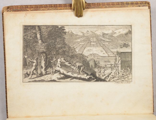
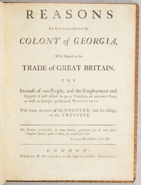
This volume also includes a lovely frontispiece of an imaginary view of Savannah, Georgia, with workers in the foreground cutting down trees and constructing a house. Martyn's work was published at the time of the founding of the colony of Georgia and includes a letter from Oglethorpe to the Trustees, the Trustees' reply letter, a list of the Trustees, and letters from Thomas Lombe (an English merchant who developed machinery for producing silk) and Robert Johnson (Governor of South Carolina). This is the first edition, second issue of Martyn's work, which is preferred due to its inclusion of Oglethorpe's letter.
12mo. Frontispiece, title, 48 pp., map. Hardbound in full pebbled leather with gilt border on covers; raised bands, gilt tooling and gilt titling on spine; marbled endpapers.
References: Cumming (SE) #211; Howes #M-356; Sabin #45002.
Condition: B+
The map, text, title page, and frontispiece have light foxing. There is a bookplate of Robert Willingham of Georgia on verso of frontispiece. The covers and spine are stained, sunned and have some abrasions, and the covers have bumped corners.