Catalog Archive
Auction 195, Lot 109

"Particular Draughts and Plans of Some of the Principal Towns and Harbours Belonging to the English, French, and Spaniards, in America and West Indies...", Bowen, Emanuel

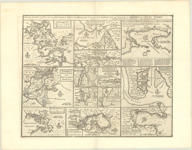
Subject: Colonial Eastern North America & West Indies

Period: 1747 (circa)

Publication: A Complete System of Geography

Color: Black & White

Size:
17.3 x 13.9 inches
43.9 x 35.3 cm
Download High Resolution Image
(or just click on image to launch the Zoom viewer)

An unusual copper engraving featuring thirteen small maps of colonial towns and sea ports including New York, Boston, Charleston, Cartagena, Martinico, St. Augustine, Havana, etc. Each map includes its own compass rose and scale of miles, and most focus on the waterways, with depth soundings, rocks, and shoals noted to aid in navigation. One of the central maps, "The Harbour of Providence," depicts Nassau, New Providence in the Bahamas, and notes that this English port is "the best planted & fortified of all the Bahama islands." At top right, the plan of Louisbourg on Cape Breton Island notes the recent British victory over the French and includes a key identifying the various batteries and the "stages on which they dress and salt the cod before they dry them."

References: Shirley (BL Atlases) T.BOW-2a #63.

Condition: A

A dark impression on a clean bright sheet with a hint of offsetting.

Estimate: $350 - $425

Sold for: $250

Closed on 11/15/2023

Archived