Subject: World
Period: 1650 (published)
Publication:
Color: Hand Color
Size:
18.8 x 12.2 inches
47.8 x 31 cm
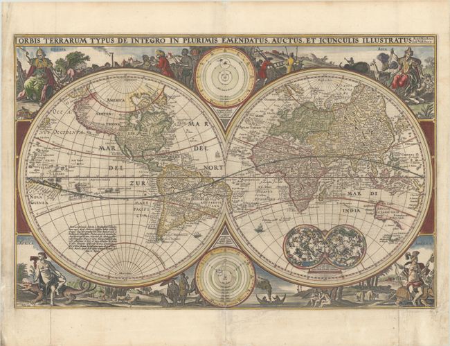
An exquisitely decorated double hemisphere world map, surrounded by engravings including allegorical representations of the continents as well as native inhabitants and wildlife. This is Visscher's first world map to be included in Dutch Bibles. It was so popular that the surrounding decorations were copied by several other cartographers. Two celestial spheres are displayed in the Eastern Hemisphere. In the lower part of the Western Hemisphere text describes the discovery of America and recent voyages of discovery. Two diagrams depicting the Ptolemaic and Copernican theories of the solar system are tucked between the hemispheres. The northwest coast of North America is exaggerated and shows California correctly as a peninsula. Parts of Australia and Van Diemen's Land are shown, but the north and east coasts of Australia are not depicted. Dutch text on verso.
References: Poortman & Augusteijn #83; Shirley #401.
Condition: B+
A sharp impression with a bit of printer's ink residue, a few tiny spots in the image, and marginal soiling. Issued folding with archival repairs to several fold separations and to a couple of tears that enter about 1/4" into image at bottom.


