Catalog Archive
Auction 194, Lot 546

"Nova et Accurata Regnorum et Provinciarum Dalmatiae, Croatiae, Sclavoniae, Bosniae, Serviae, Istriae, et Reip. Ragusanae...", Seutter, Matthias

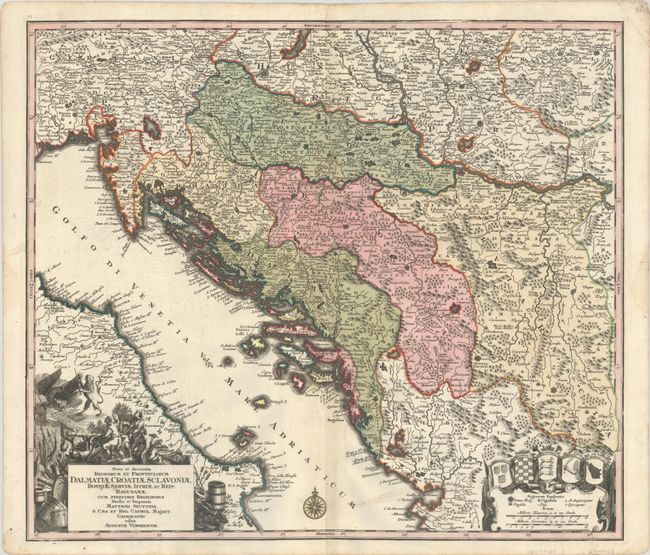
Subject: Western Balkans

Period: 1740 (circa)

Publication:

Color: Hand Color

Size:
22.6 x 19.6 inches
57.4 x 49.8 cm
Download High Resolution Image
(or just click on image to launch the Zoom viewer)

A densely engraved map centered on the Dalmatian coast extending from Slovenia to northern Albania, as far east as Orsova along the Danube River, and including part of the coastline of southern Italy. The map is filled with hundreds of tiny towns, river systems, and pictorial mountain ranges. The distance scale includes a legend and the coats of arms for the various regions. The title cartouche features symbols of war and an eagle battling a lion.

References:

Condition: B+

A sharp impression with full contemporary color on a watermarked sheet with a bit of printer's ink residue, minor soiling, and faint toning along the centerfold.

Estimate: $300 - $375

Sold for: $220

Closed on 9/13/2023

Archived