Subject: Cartographic Miscellany, Games, Eastern United States
Period: 1840 (circa)
Publication:
Color: Hand Color
Size:
19.5 x 26.4 inches
49.5 x 67.1 cm
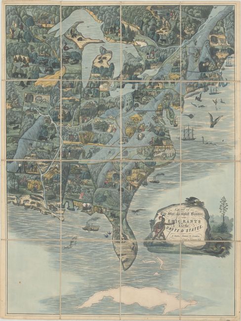
This highly decorative game is one of the earliest to feature a map of the United States in its design. The game leads players through 147 stops throughout the region, and was designed to teach a British audience (mainly children) about America. The game begins near a serpent in the Atlantic Ocean (which was reportedly witnessed in 1817) and heads west through New York and the Ohio Valley, meandering across both the eastern U.S. and Canada before eventually returning to New York City.
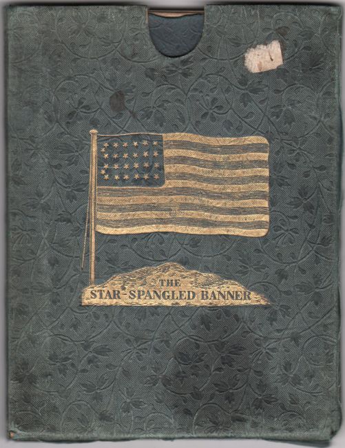
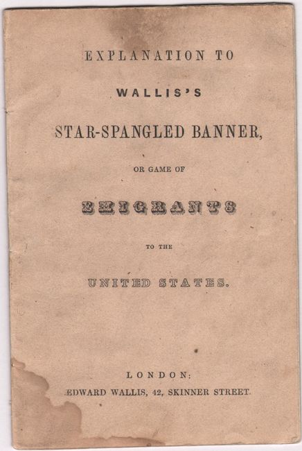
The mesmerizing pictorial map is filled with gorgeous illustrations of wildlife, forests, mountains, cities, important buildings, and much more. The southern United States is dominated by scenes of agriculture, including several depictions of slaves harvesting crops and an unfortunate hanging scene (#90). In the accompanying explanation, Wallis condemns this scene (demonstrating the Lynch Law) as “a mockery of justice, by which persons who offend against the popular opinion, are tried and executed by illegal and self-constituted judges.” Other illustrations of interest include: a rattlesnake in Virginia (#50) described as “at all times, and under all circumstances, highly malignant and dangerous”; gold mines in South Carolina (#59) and Georgia (#61); alligators (#72) that “destroy numbers of pigs, calves, and sometimes even children”; and a grizzly bear (#103) whose “very name is dreadful, as his disposition is bloodthirsty.” The map is adorned by a decorative title cartouche featuring a native, eagle, and snake surrounding the large boulder title. Folds into its original slipcase and the original 16-page explanation is present.
Map games were a popular sideline for cartographic publishers from about 1760 onward in England, with John Bowles publishing the earliest geographical game in 1759. John Wallis Sr. and his son Edward began working together as mapsellers and publishers, and by the 1790s, Wallis' business began to focus on map games, at which point they began to dominate the London market for such items.
References:
Condition: A
A clean and colorful example. Issued folding and backed on original linen with minor soiling mostly in the margins. Text is mostly clean with some soiling and dampstaining on the title page. Front text wrapper is missing. Slipcase has light wear with mild sunning and staining on the front cover. There are small remnants of hinge tape on the versos of the map, slipcase and text from a previous framing.