Catalog Archive
Auction 194, Lot 440

"Magnae Prussiae Ducatus Tabula, Denuo Correcta et in Lucem Edita", Visscher/Schenk
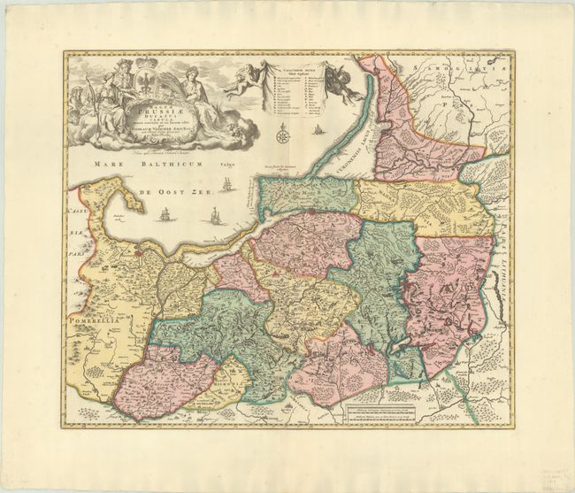
Subject: Baltic

Period: 1720 (circa)

Publication:

Color: Hand Color

Size:
20.6 x 17.2 inches
52.3 x 43.7 cm
Download High Resolution Image
(or just click on image to launch the Zoom viewer)

This is a superb map of the Prussian Empire, which includes present-day Poland, Lithuania and the Russian enclave of Kaliningrad (here Konigsperg). The map is beautifully engraved to illustrate the many lakes, rivers and forests. The elaborate title cartouche and map key fills nearly the entire sea and is surrounded with allegorical figures, a coat of arms, and putti. Sailing ships and a compass rose further embellish the chart.

References:

Condition: A+

A sharp impression with full contemporary color on a bright, wide-margined sheet.

Estimate: $550 - $700

Sold for: $400

Closed on 9/13/2023

Archived