Subject: London, England
Period: 1921 (dated)
Publication:
Color: Printed Color
Size:
13.3 x 10.1 inches
33.8 x 25.7 cm
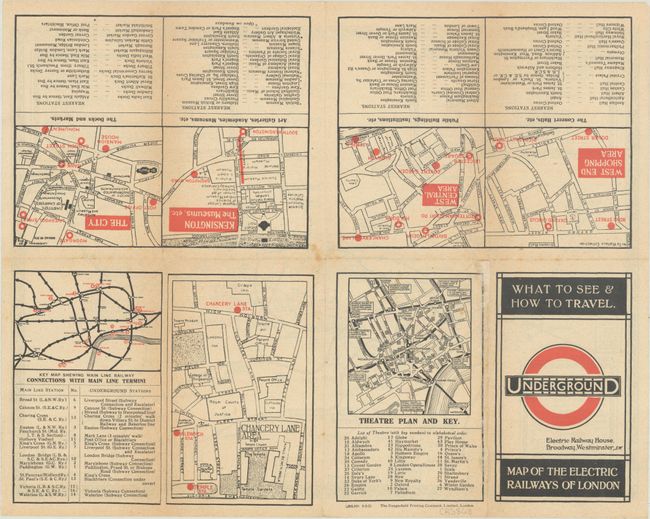
This early London Underground map is the first to include MacDonald Gill’s imprint. It is also the first version of the map to focus solely on the underground network, showing no topographical details above ground. The various rail lines are color-coded to reveal seven different companies in operation including the District Railway, London Electric Railway, Metropolitan Railway, and several others. It wouldn’t be until 1933 that these lines merged into one public entity under the London Transport umbrella. The verso contains additional information for passengers including 7 small maps with points of interest for the West End Shopping Area, Kensington, The City, and more. Printed by The Dangerfield Printing Company in London.
MacDonald Gill was one of several artists who attempted to show the evolving London Underground in the early part of the 20th century. Gill used a geographically-based approach which resulted in a high density of information inside the city, making it more difficult to read and use the map. In 1931, Harry Beck designed a different kind of map that used straight lines and 45-degree angles to simplify this density issue. Beck's map was published in 1933 and became the standard for all future Underground maps (including today).
References:
Condition: B+
Issued folding with light toning along the fold lines.