Subject: Peru
Period: 1600-63 (circa)
Publication:
Color: Black & White
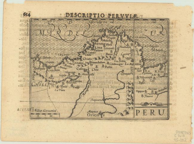
A. Peru, by Petrus Bertius, from Tabulae Geographicae Contractae, published 1600 (4.9 x 3.5"). An interesting miniature map oriented with north at right. Major cities and villages are noted. Simple strapwork cartouche. Latin text on verso. This map was originally published in Cornelis Claesz' Map-Treasury, with maps engraved by Jodocus Hondius and Pieter van den Keere. References: King (2nd ed.) pp. 80-82; Van der Krogt (Vol. III) #9820:341. Condition: A dark impression with show through of text on verso. (B+)
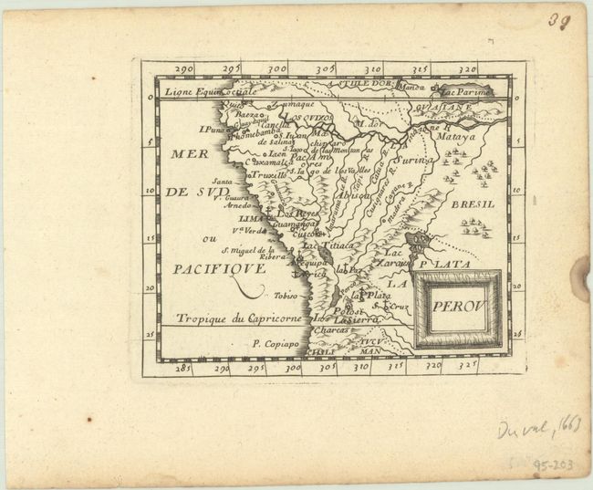
B. Perou, by Pierre Duval, from Le Monde ou la Geographie Universelle, circa 1663 (4.9 x 4.0"). Charming miniature map covering the region from the Equator to the Tropic of Capricorn. At upper right corner in Guaiane the mythical Lac Parime with the golden city of Manoa are shown. Pierre Duval was Nicolas Sanson's nephew and pupil. He published a wide range of atlases and individual maps including a fine miniature world geography with many of the maps based on Sanson. References: King (2nd ed) pp. 132-135; Pastoureau, Duval XI C. Condition: A sharp impression on a bright sheet with a small damp stain in right margin. (A)
References:
Condition:
See description above.