Subject: Barbados
Period: 1745 (circa)
Publication: Just Publish'd Atlas Minor
Color: Hand Color
Size:
13.7 x 11.1 inches
34.8 x 28.2 cm
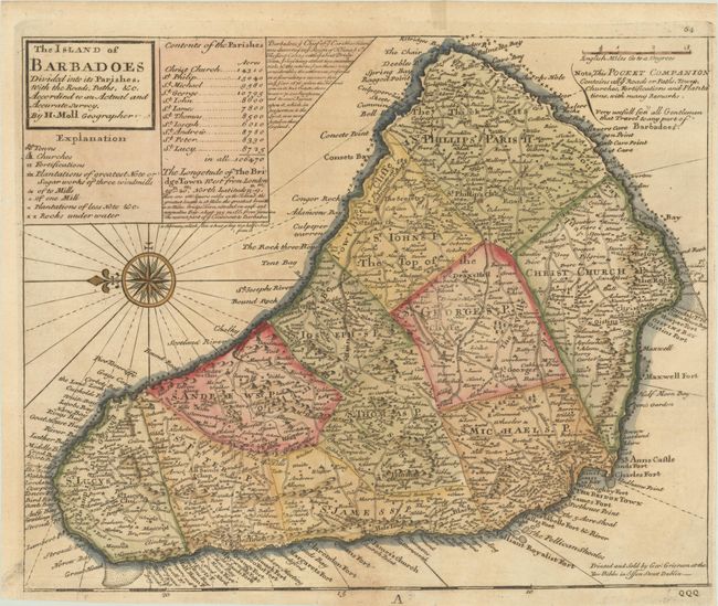
This is a pirated edition of Moll's map of Barbados, re-engraved and published by George Grierson. The map shows the island fully engraved and filled with towns and villages, roads, mills, plantations, political divisions, and many coastal details. A very decorative compass rose places north to the left. Contained in the title cartouche is a legend and a list of the eleven parishes, each with their population. Note at upper center gives a brief history of Barbados from the reign of King James I. This edition includes Moll's notes at upper right that "This Pocket Companion Contains all ye Roads or Paths, Towns, Churches, Fortifications and Plantations…" and is "very usefull for all Gentlemen that travel to any part of Barbadoes." This map appeared in both Thomas Salmon's Modern History and Grierson's Just Publish'd Atlas Minor.
References: Campbell (MCC-21) #24; McCorckle #, Vol. V, part 2 [7].
Condition: B+
A dark impression, issued folding on a lightly toned sheet with the watermark of the Amsterdam arms. Trimmed close to neatline at right with a small worm hole in the left margin.