Subject: Santa Fe, New Mexico
Period: 1950 (dated)
Publication:
Color: Black & White
Size:
13.9 x 18.3 inches
35.3 x 46.5 cm
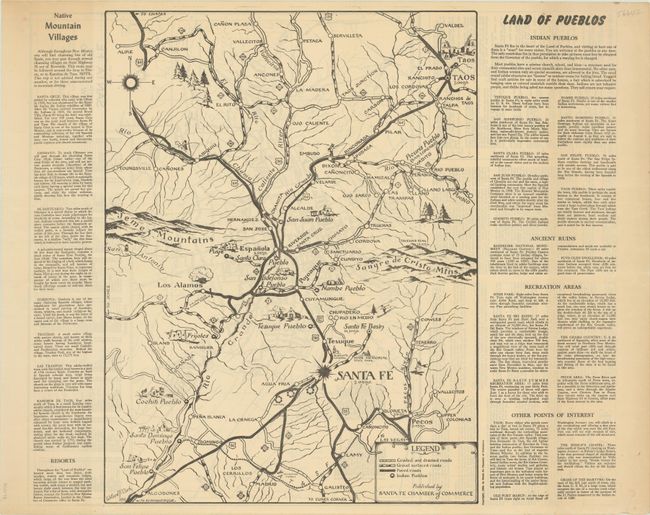
This double-sided map provides a detailed look at Santa Fe and its vicinity. On recto is Land of Pueblos, an attractive map with pictorial elements that spans from San Felipe Pueblo northeast to Taos. The map is bound by the Jemez Mountains in the west and the Sangre de Cristo Mountains in the east. Pueblos are named and accompanied by illustrations. A giant mushroom cloud appears in Los Alamos. Willard F. Clark, the map's designer, was a machinist at Los Alamos and a veteran of the Manhattan Project. A legend at bottom right identifies graded and drained roads, gravel surfaced roads, paved roads, and pueblos. The full sheet measures 24.1 x 19.1", with surrounding text that discusses native mountain villages, resorts, pueblos, ruins, and more.
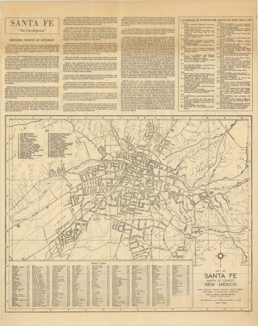
On verso is a map of Santa Fe ("The City Different") by the New Mexico State Highway Department (18.3 x 14.6"). It features an extensive street index and a key that indicates 37 sites of interest, including the capitol building, the Palace of the Governors, and several schools and historic churches. Above the map is text describing historic points of interest and a calendar of events in the region for 1950.
References:
Condition: B+
There is light toning primarily along the edges of the sheet.