Subject: Alabama
Period: 1849 (dated)
Publication:
Color: Hand Color
Size:
16.3 x 20.8 inches
41.4 x 52.8 cm
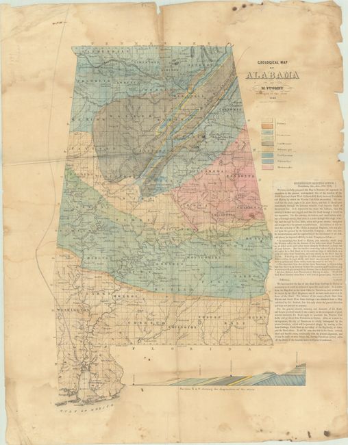
This important and scarce map is the first geological map of Alabama. It was issued separately but accompanied Tuomey’s First Biennial Report of the Geology of Alabama published in 1850. The map itself identifies 9 different geological types via hand coloring along with towns, post offices, rivers, and a single railroad. The “Boundary Line between the Creek & Cherokee Indians” is also noted along the border with northern Georgia. A small profile at bottom presents a cross-section from Mobile to Huntsville. This example features a printed notice dated “Jan. 18 1858 Tuscaloosa” pasted onto the right margin, and refers to the map in appealing the location of a proposed railroad route.
The Marcou reference is for an 1848 version of this map which was likely a proof copy of the 1849 map and is virtually unobtainable today. We found no past sales records for this 1849 map and seven institutional examples located on OCLC.
References: cf. Marcou & Marcou #547.
Condition: C+
Issued folding with light dampstains, some extraneous creasing, and minor foxing. There are a few fold separations that have been partially closed with old tape and a number of tiny holes adjacent to the fold lines that are only visible when held to light.