Subject: World
Period: 1794 (circa)
Publication: A New Geographical, Historical, and Commercial Grammar
Color: Hand Color
Size:
14.1 x 7.4 inches
35.8 x 18.8 cm
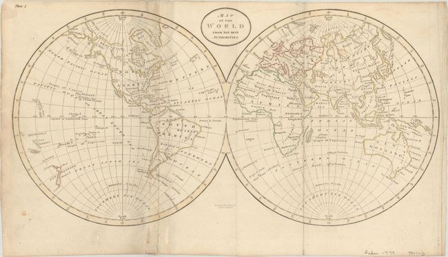
This double hemispheric world map incorporates the discoveries of Capt. Cook. Of interest is the depiction of a huge New South Wales that stretches across the entire east coast of New Holland from Van Diemens Land (still attached) to the Cape York Peninsula. New Guinea's southern coastline is indistinctly drawn. A note near Hawaii states, "Owhyhee where C. Cook was killed." Engraved by B. Baker.
References: McCorkle (18th C. Geog. Books) #171-1.
Condition: B+
Issued folding, now flat, with light soiling and a couple tiny splits along the fold at left that have been closed on verso with archival materials. There are a couple wormtracks in the bottom blank margin that have also been archivally repaired on verso.