Catalog Archive
Auction 194, Lot 190
NO RESERVE
"Map of the Indian Colonies West of Missouri and Arkansas", Eastman, Seth (Capt.)
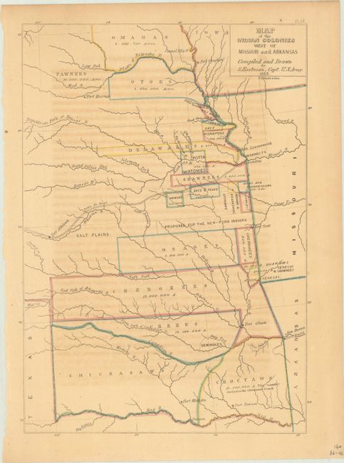
Subject: Central United States
Period: 1853 (dated)
Publication: Information Respecting the History, Condition and Prospects of the Indian Tribes of the United States
Color: Hand Color
Size:
7.8 x 11.3 inches
19.8 x 28.7 cm
Download High Resolution Image
(or just click on image to launch the Zoom viewer)
(or just click on image to launch the Zoom viewer)