Subject: World
Period: 1787 (circa)
Publication:
Color: Hand Color
Size:
11.9 x 6.9 inches
30.2 x 17.5 cm
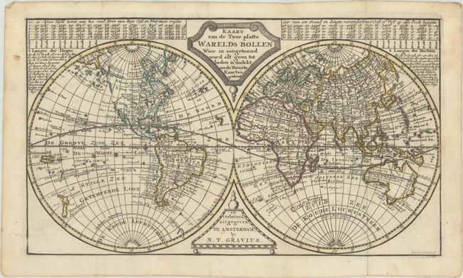
This is a later edition of Jacob Keizer's double-hemisphere world map of the same title, with updates based on recent explorations. New Zealand is fully delineated and the eastern coast of Australia is beginning to take shape based on Captain James Cook's second voyage, although Tasmania is still connected to Australia. The location of Cook's death in the Sandwich Islands (Hawaii) in 1779 during his third voyage is noted. The new United States is named "XIII Vereen State" and extends west to the Mississippi River. A River of the West (West Rivier) extends from the Pacific well into the middle of North America, and the coastline of the Pacific Northwest is conjectural north of the river. Despite knowledge of Cook's third voyage, Alaska has not yet taken shape. Engraved by H. Klockhoff.
References:
Condition: A
A sharp impression with contemporary outline color, issued folding on a sheet with the watermarks of a Strasbourg Lily and "C&I Honig." There are a few minor spots of foxing.