Subject: South Pacific Ocean
Period: 1795 (dated)
Publication:
Color: Hand Color
Size:
22.5 x 17.7 inches
57.2 x 45 cm
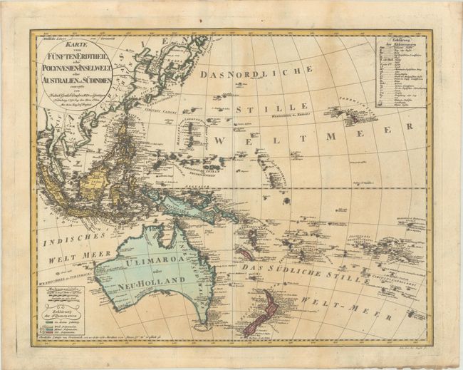
This great map of the southern Pacific Ocean covers the region from Southeast Asia to Hawaii, and from Australia to French Polynesia. It is based on a 1780 Swedish map by Daniel Djurberg, which in turn was based on the work of Lt. Henry Roberts, who served with Captain Cook on his last two voyages. Australia is labeled Ulimaroa, the name the Maoris of New Zealand used when describing 'a place to the north' to Capt. Cook. Djurberg concluded that the name referred to Australia. The eastern coastline of Australia illustrates the exploration of Cook in 1770. But the continental shape is still far from complete with a conjectural southern shoreline and Tasmania still attached to the mainland. A color-coded legend at bottom left identifies the regions belonging to Asia and to West, Central and East Polynesia. Engraved by Joh. Lor. Jac. Rausch.
References:
Condition: B+
A dark impression on a sheet with a large "4" watermark, light toning, some extraneous creasing along the centerfold, and soiling along the bottom edge of the sheet.