Subject: Egypt
Period: 1743 (dated)
Publication:
Color: Hand Color
Size:
18.8 x 24.1 inches
47.8 x 61.2 cm
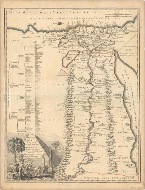
This rare, separately-issued map of the Nile River valley was the first map of the region published by the Robert de Vaugondy family. It provides good detail of towns, villages, and pyramids, and notes the distances between towns. Some of the features on the map are exaggerated, including the mountain ranges running parallel to the Nile River and Lake Moeris. The depiction of the lake corresponds with the writings of the Greek historian Herodotus, and includes a large island at the center on which stand the Pedestals of Biahmu. The map is decorated with a large title cartouche engraved by Gobin, featuring the pyramids, the Sphinx, an obelisk, a sarcophagus, and a river god.
This map is quite rare, and we have found only 2 other examples available for sale in the last 25 years.
References: Pedley #430.
Condition: B+
A nice impression with contemporary outline color on a sheet with the watermark of a Maltese cross encircled in rosary beads. There is light soiling, minor toning, and a 3" tear below "Arcadia" that has been closed on verso with archival tape.