Subject: Northern France, Paris
Period: 1947 (dated)
Publication:
Color: Printed Color
Size:
36.3 x 30.5 inches
92.2 x 77.5 cm
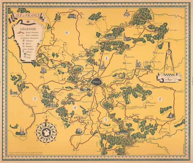
This pictorial map of the Ile de France region was drawn by Jean Moles and published by the French Ministry of Travel to promote tourism. Centered on Paris, the map extends to include Chartres, Fontainebleau, Meaux, St. Denis, and more. A legend at top left further identifies roads, castles, churches, beaches and golf courses. The map is decorated in a classic style with strapwork title cartouche, distance scale featuring dividers, 16-point compass rose, and fancy border.
References:
Condition: A
A colorful example with some minor toning and creasing along the sheet edges.