Subject: Northern France
Period: 1680 (circa)
Publication:
Color: Hand Color
Size:
29.7 x 15.9 inches
75.4 x 40.4 cm
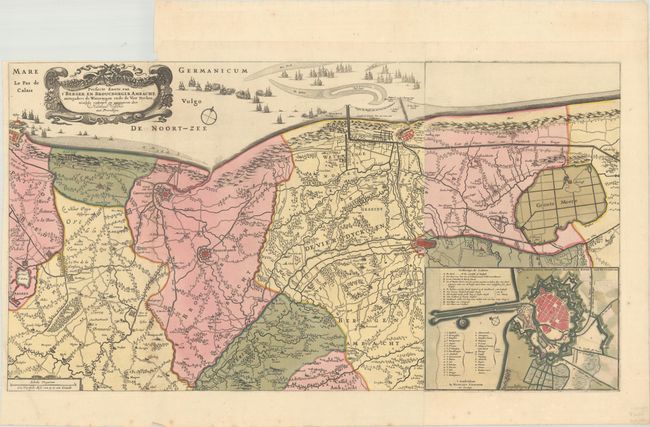
This is a highly detailed map (described by Visscher as a "perfect map") of the coastline between Calais and Dunkirk, extending as far inland as Watten. Roads, towns, rivers, canals, forested areas, and political boundaries are illustrated, with the larger cities depicted as miniature bird's-eye plans. The inset at bottom right gives a more detailed plan of Dunkirk with a lengthy key identifying locations. The North Sea is adorned with numerous ships, some engaged in battle. Printed on two sheets, joined as issued. A very uncommon map.
References:
Condition: B+
A sharp impression with full contemporary color on bright sheets, issued folding, with a binding trim at top left. The left margin is a bit narrow but ample for framing. There are a few spots of foxing along the left-hand fold and there is a tiny tear in the image along the left fold that has been closed on verso with archival tape.