Subject: Western Europe, Rhine River
Period: 1740 (circa)
Publication:
Color: Hand Color
Size:
21.5 x 22.5 inches
54.6 x 57.2 cm
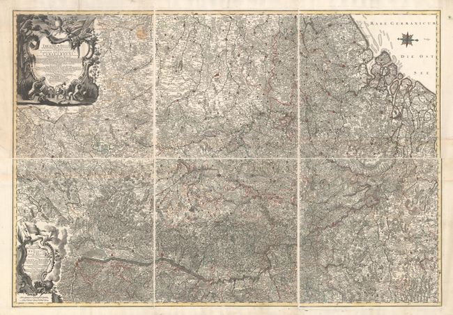
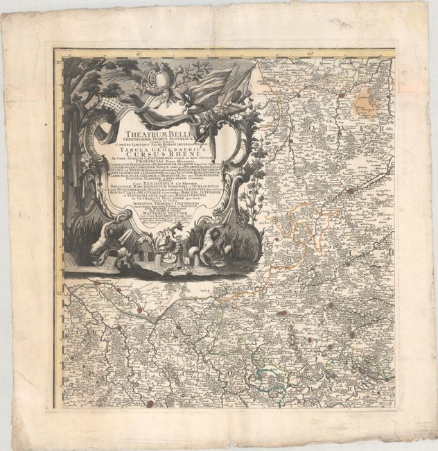
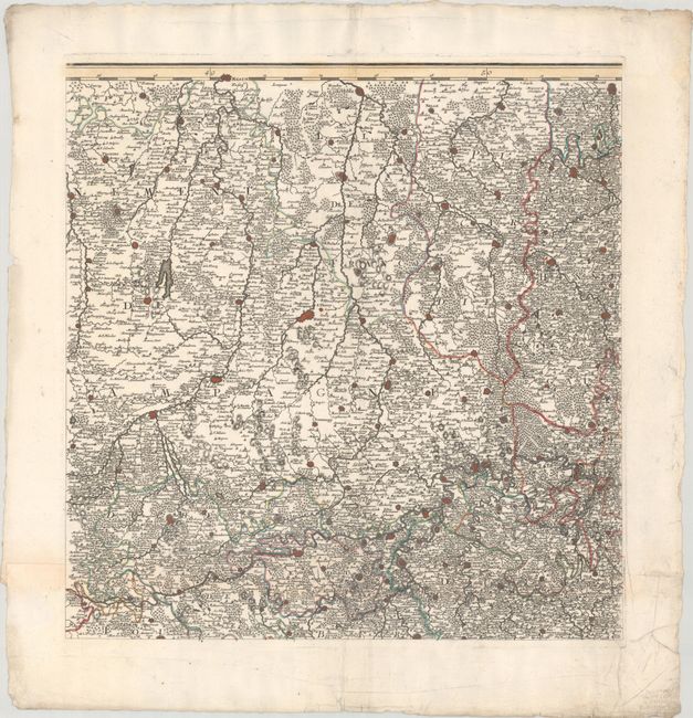
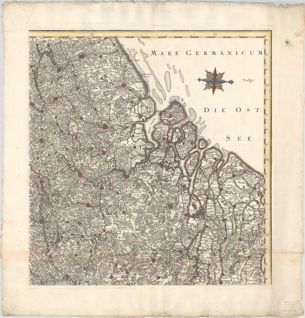
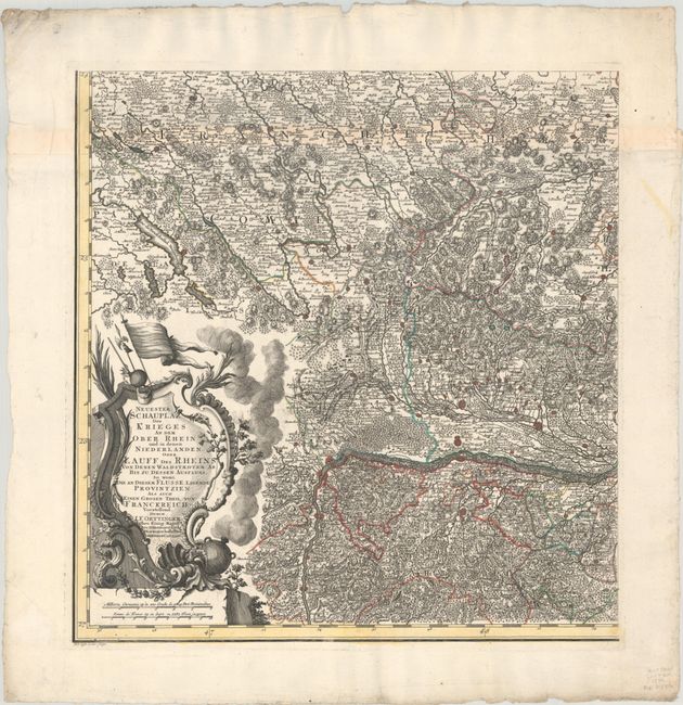
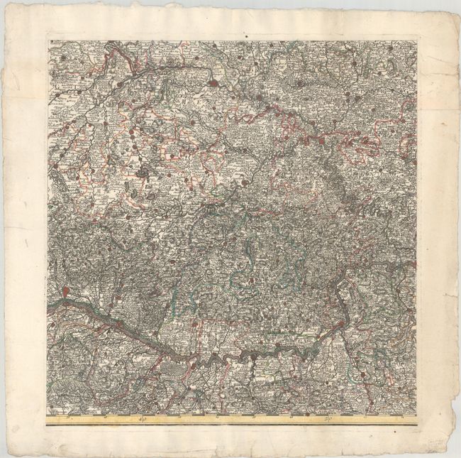
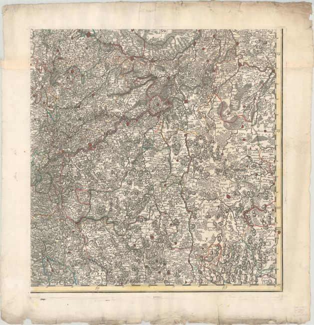
This superb six-sheet map is based on the work of Johann Friedrich Oettinger and depicts the theater of war in the Low Countries and surrounding the Rhine River. The map is oriented with north to the right and extends from Utrecht in the north to Basel in the south, and from Arras, France in the west to just past the Rhine River in the east. The map is densely engraved with hundreds of tiny towns, with larger cities depicted as miniature fortified plans. The map includes two large title cartouches, one in Latin and one in German, which are festooned with symbols of war and river gods. Each sheet is printed on two joined sheets, as issued. A very uncommon map.
References:
Condition: B+
Sharp impressions on bright, deckle-edged sheets with contemporary color and light soiling. There is a stain in the top right corner of the top left sheet. There are a number of edge tears on the sheets, none of which enter the image, and heavier soiling along the edges of several of the sheets. The first image is a composite image - the map is in 6 separate sheets.