Subject: North Pole
Period: 1636 (published)
Publication: A Geographicke Description of the Regions, Countries and Kingdomes of the World...
Color: Black & White
Size:
19.5 x 17 inches
49.5 x 43.2 cm
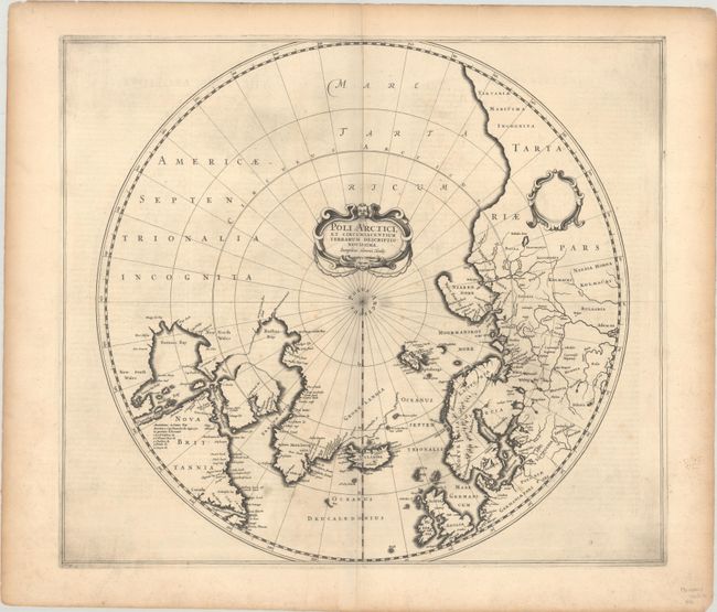
A very early edition of Hondius' important map of the polar region that replaced Mercator's polar map and incorporated much of the knowledge gained by the English in their search for a Northwest Passage to Asia. The North American cartography is based on Henry Briggs depiction of Hudson Bay. Numerous discoveries are shown including those of Frobisher, Davis, Baffin, Hudson, Button, Foxe, and James. There are several Dutch names in Labrador, many appearing for the first time on this map. English text on the verso describes the peoples, animals (including unicorns) and explorations of the North Pole. Second state of this map with the title added but without the whaling scenes.
References: Burden #246; Kershaw #97; Van der Krogt (Vol. I) #0020:1B..
Condition: B+
A dark impression on a strong, watermarked sheet with just a few spots of light foxing in the image and toning and soiling confined to the edges of the sheet.