Subject: North Atlantic, Greenland
Period: 1670 (circa)
Publication:
Color: Black & White
Size:
11.1 x 7.1 inches
28.2 x 18 cm
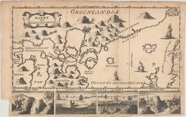
This unusual little map extends from Spitsbergen to northern Canada, which is labeled both America and Nova Dania to the west of Hudson Bay. Only the southern tip of Greenland is depicted and is still attached to North America. Illustrations in the interior reveal hunting scenes. Iceland and the mythical Frislandia are located off the coast. Beneath the map image are four small illustrations featuring a hunter, sea monster, and natives. Further decorated by three sailing ships and a strapwork title cartouche. We found only one other sales record for this map in the last 40 years.
References:
Condition: B
Issued folding with some light toning and foxing. A short fold separation that just enters the border at top has been archivally repaired on verso. There is a short binder's trim at lower left.