Subject: Southern United States, Mexico & Central America
Period: 1854 (dated)
Publication:
Color: Hand Color
Size:
24.1 x 17.4 inches
61.2 x 44.2 cm
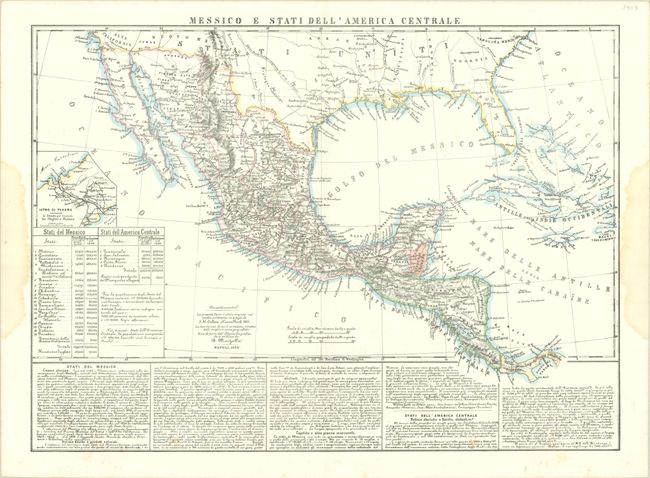
This scarce lithograph, according to the advertisement at the bottom of the map, is based upon Colton's four-sheet map of 1851. The map extends from the southern United States down to Panama and includes the western Greater Antilles. The border between the United States and Mexico is along the Gila River, suggesting this map was published just before the Gadsden Purchase. A small inset presents the Isthmus of Panama and depicts the path of the Panama Canal Railway, which was scheduled to open in 1855. Tables at left show both land area and population for the various Mexican and Central American states. Marzolla includes detailed descriptions of each region below the map.
References:
Condition: B+
Issued on a bright sheet with some faint spots of foxing. Dampstains in the side margins just touch the border.