Subject: World
Period: 1808 (dated)
Publication: Atlas to Cruttwell's Gazetteer
Color: Hand Color
Size:
17.6 x 9.7 inches
44.7 x 24.6 cm
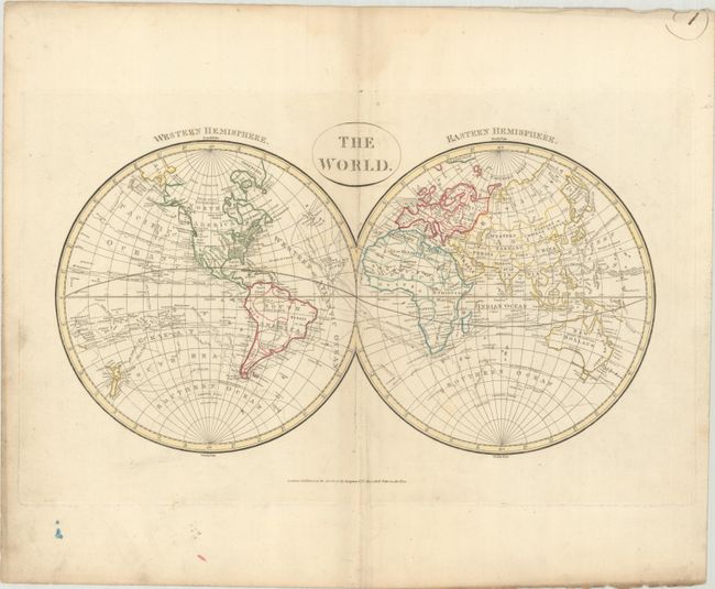
This handsome double hemispheric world map shows the tracks of many explorers, including Cook, Anson, Bougainville, Wallis, and the trade route of the Manila galleons. In the United States, Virginia, the Carolinas, and Georgia all extend to the Mississippi, with French Louisiana and Spanish New Mexico to their west. The west coast is labeled New Albion. A notation along the western coast of North America indicates that the "West R discovered 1603." The mythical L. de los Xarayes is located in the heart of South America. Company Land appears to the north of Japan. There is good detail of South Pacific Islands, although the coastline of Papua New Guinea is still incomplete. The only sign of Antarctica are several notes about ice. Published by Longman & Co.
References:
Condition: B+
Contemporary outline color on a sheet with wide margins and 1805 watermark. There is soft extraneous creasing and minor foxing along the centerfold. There is light soiling that is mostly confined to the margins and a faint dampstain in the upper margin. "Port Jackson" is noted in manuscript ink in Australia.