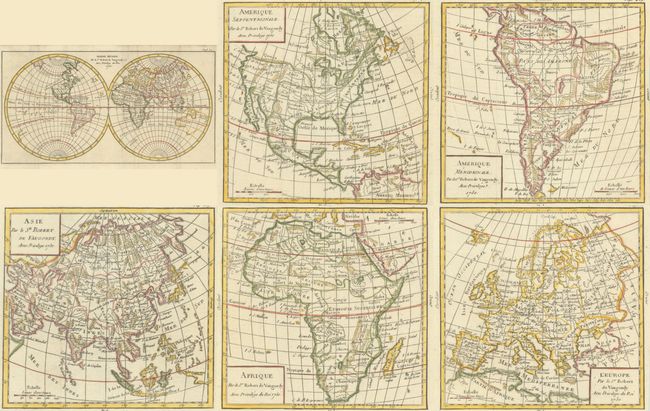
Subject: World & Continents
Period: 1750 (dated)
Publication: Methode Abregee et Facile pour Apprendre la Geographie
Color: Hand Color
Nice set of six matching maps. Dated 1750, but probably published in a later edition of the Methode Abregee et Facile pour Apprendre la Geographie as the page numbers do not match with those listed in Pedley. Included are:
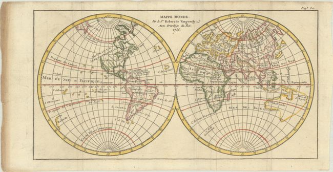
A. Mappe Monde, (10.8 x 5.6"). This small double-hemisphere world map shows a blank western coastline of North America above California. Australia is composed of a a conjectural eastern coastline that is connected to Tasmania, Terre du S. Esprit, and New Guinea. The Antarctic region is virtually blank.
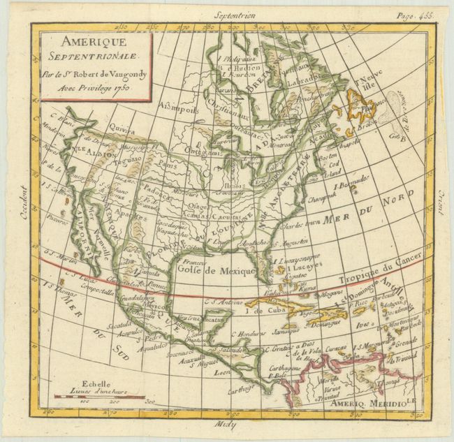
B. Amerique Septentrionale, (6.0 x 5.9"). The western part of North America is labeled Nle. Albion with Quivira above and Teguaio in the area of today's Utah. The entire Northwest coast above Albion is blank and partially hidden by the square cartouche. There is an open-ended bay in Hudson Bay allowing for the possibility of the Northwest Passage. Apaches are correctly located in the Southwest, and Texas is named Cenis and is a part of Spanish Floride, which incongruently does not include Florida. The British Colonies are shown along the eastern seaboard, with the large French possessions of Louisiane to the west.
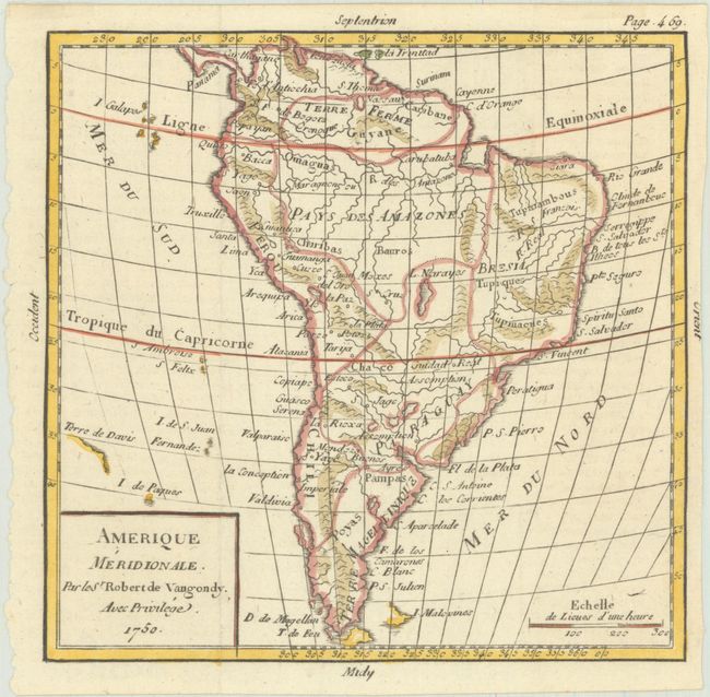
C. Amerique Meridionale, (6.0 x 5.9"). South America is shown with some topographical detail, as well as the Amazon and La Plata Rivers.
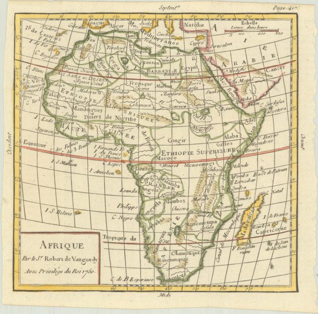
D. Afrique, (6.0 x 5.9). The map of Africa locates the source of the Nile a bit too far north, with some notations of topography.
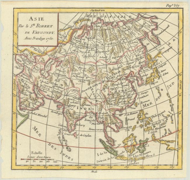
E. Asie, (6.0 x 5.9). Asia is well detailed for such as small map, with depictions of the mountain ranges and rivers and towns from Russia to New Guinea.
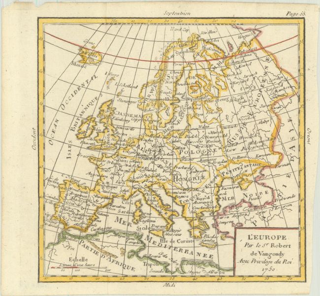
F. L'Europe, (6.0 x 5.9). The map of Europe shows country divisions, as well as the major cities.
References: Pedley #7, #31, #374, #425, #447, #486.
Condition: A
Crisp impressions, issued folding on bright sheets. The world map has several misfolds, heavy soiling on the left edge of the sheet, and three tiny pieces of tape along the top edge of the sheet on recto. The first image is a composite image - the maps are on individual sheets.